Share
UAV-mounted LiDAR was able to discover hidden traces of history near Vienna in a recent pilot project. Franziska Reiner, Bright Danthine and Christian Kurtze discuss the difficulties of surveying the area from the air - and what they found.
In the course of the project Archaeology at the Danube - Bisamberg Pilot Study conducted by the Austrian Archaeological Institute (ÖAI) of the Austrian Academy of Sciences (ÖAW) - a survey of the archaeological ground monuments on the Bisamberg was carried out using modern non-invasive aerial and ground prospection methods.
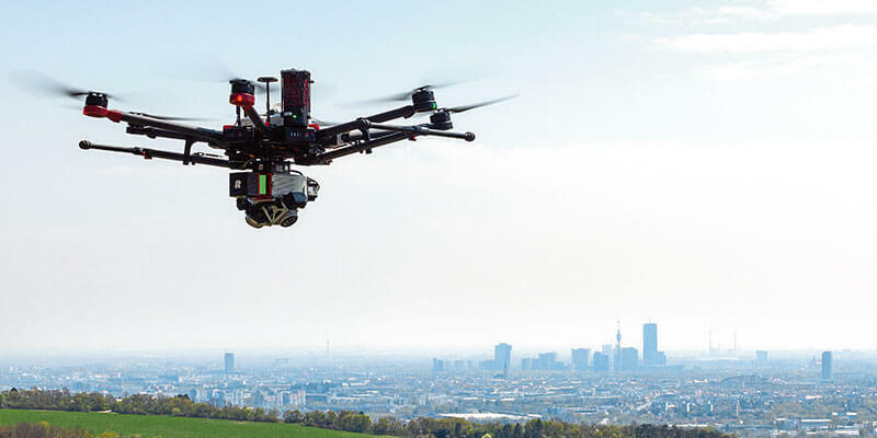
The Bisamberg is an approximately 358m rise north of Vienna in Austria, whose southernmost foothills reach into the 21st district of Vienna. Together with the Leopoldsberg flanking the Danube across the river, the two hills form the Vienna Gate. Traces of settlements around and on the Bisamberg have been known since the Mesolithic period around 8,000BC. Prehistoric finds were made as early as the second half of the 19th century and the existence of a rampart was postulated. As part of the pilot study, high-resolution, copter-supported LiDAR terrain surveys over 50ha were carried out. The system used in this pilot study consisted of the RIEGL miniVUX-3UAV LiDAR sensor for object acquisition and the APX-20 UAV INS/GNSS for trajectory acquisition.
Primarily, the course of a presumed prehistoric rampart was to be better revealed, but military structures could also be captured in the process. Due to its special topographical position, the Bisamberg was regularly involved in military strategies for the protection of Vienna. Several entrenchments, among others also on the Bisamberg, were built as defensive fortifications to secure Vienna in connection with the Prussian-Austrian War of 1866. These entrenchments were reactivated again and again in the course of history and were still used for military purposes in the Second World War. A few entrenchments are still partially recognisable in the terrain today, but can hardly be seen in aerial photographs.
A challenging flight path
Christian Kurtze, a former ÖAI staff member and executive UAV pilot on this mission, had to deal with some particular challenges in the flight planning as a radio mast on the Elisabethhöhe (the highest plateau of the Bisamberg) caused some disturbances. Therefore, an area of 25m around the radio mast was defined as a "no fly zone".
Furthermore, the dense tree population as a well as the relatively strongly moving topography in the northern and western parts of the flight area caused some difficulties. (It should be noted that the best time for flying before the early leaves sprouted could not be adhered due to technical reasons.)
In addition to the difficulties, there was the technical requirement to guarantee a uniform point pattern with a very high point density on the ground to gain a complete coverage, resulting in a really informative 3D point cloud.
To realise this very complex task, the flight planning software universal Ground Control Station (UgCS) from SPH Engineering was used. A great advantage of UgCS is the integration of digital terrain models - on the one hand ,this enables an interactive three-dimensional view of the flight path and the surrounding area; on the other, the planned trajectory can be calculated on the basis of the terrain model data as a constant flight altitude relative to the topography.
The flight mission was carried out using a DJI M600 UAV platform carrying the RIEGL miniVUX-SYS airborne laser scanning system which was installed by means of an Integration Kit 600, an easy to-use setup for a quick installation. The pre-set system configuration is already loaded onto the system and does not need any input from the operator. That enables the platform to be ready to fly in minutes.
The flight parameters were calculated with RiPARAMETER, RIEGL's proprietary and free to use software to evaluate the optimal scan parameters, based on an a-priori estimated target point density. The project's flight altitude was 50m above ground level (AGL). The flight speed was set at 6m/s (22km/h), whereby both values were slightly corrected during the detailed planning in order to adjust best to the local conditions. The flight area was then divided into three mission zones of approximately equal size, so that the view of the copter from the pilot's position was guaranteed and the differences in altitude within the zones do not vary too much in terms of the copter's energy consumption.
In addition, a second mission was created for each zone, whose flight direction was rotated 90° in relation to the first mission. In this way, the area was surveyed from two difference directions to guarantee the most complete coverage possible through the intensive penetration of the treetops.
The data was afterwards processed so that any vegetation was filtered out in several processing steps to obtain the pure digital elevation model (DEM) of the entrenchment and the surrounding area. To improve the visibility of the different structures, the DEM was visualised with the help of the Relief Visualization Toolbox using different algorithms. The Relief Visualization Toolbox was developed specifically for the small-scale area and is therefore perfectly suited to display high resolution elevation data in the field of archaeology and to make otherwise invisible features visible.
While in the aerial photograph of 1938 the entrenchment is still clearly recognisable due to the absence of vegetation, in later years and by the time of the aerial photograph of 1976 the structure is no longer distinguishable. The LiDAR scan, however, again shows the structures of the entrenchment very clearly, with individual structures becoming much more prominent due to the different renderings.
Franziska Reiner is a geophysicist and Brigit Danthine is an archaeologist working in the technical unit at the Austrian Archaeological Institute of the Austrian Academy of Sciences (www.oeaw.ac.at/oeai). Christian Kurtze is a former surveyor at the Austrian Archaeological Institute of the Austrian Academy of Sciences.


