Share
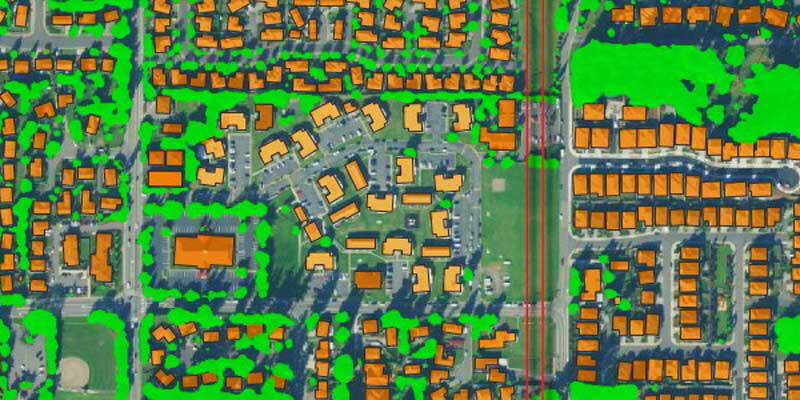
EarthDefine, a provider of high-resolution geospatial spatial data that uses artificial intelligence (AI) to analyse aerial and LIDAR imagery, announced the release of an updated building footprint database, which contains over 156 million footprints of commercial and residential structures across the continental United States. EarthDefine’s latest update will allow insurers to identify with rooftop accuracy where structures fall within a parcel of land to improve risk rating, quoting accuracy, and claims response. EarthDefine’s building footprints are generated using state-of-the-art deep neural networks. Neural networks are a type of artificial intelligence (AI) algorithm that can provide accurate extraction of ground features like building footprints, parking lots, trees, swimming pools, solar panels, etc., from aerial imagery and LIDAR data across large scales and highly diverse geography. www.earthdefine.com


