Share
Interferometric synthetic aperture radar technology is bringing subsidence – and potentially stability – to the surface in California. Mary Jo Wagner explains how.
When it comes to natural disasters, the sudden, swift devastation of landslides, mudslides and sinkholes may get all the attention, but natural resource scientists will tell you the slow sinking of the ground surface is just as real a danger.
Gone unchecked, little slumps of subsidence can eventually lead to significant impacts and costly repairs to water conveyancing systems, damaged buildings, roads, bridges and levees. Once repaired, there is also the expense of constructing mitigating measures to prevent future subsidence-induced damage.
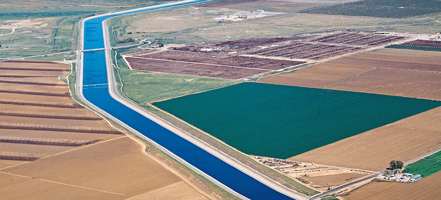
One area that is no stranger to subsidence is the state of California in the US, where the historically unmonitored and unregulated practice of groundwater pumping has led to declining groundwater levels in many basins across the state and has created pockets of displacement – some greater than 7.5m. In many of these regions, subsidence continues today, sometimes at nearly historically high rates of more than 30cm/year.
“We know subsidence risk is more acute during droughts, when more people rely on groundwater,” says Steven Springhorn, a programme manager in the California Department of Water Resources (DWR)’s office of sustainable groundwater management. “And given the intensifying drought conditions in California and our reliance on groundwater, we’ve needed to advance sustainable groundwater management and pursue innovative tools to better manage and report subsidence throughout the state.”
One of those innovations is interferometric synthetic aperture radar (InSAR), a satellite- based data analysis technique that measures changes in the earth’s surface over time with millimetre precision. With its large area coverage, frequency and precision, InSAR technology has not only enabled the DWR to develop its first- ever statewide subsidence monitoring system, it’s also bringing undetected subsidence to the surface, giving water managers a consistent source of ground-movement intelligence to help them improve groundwater management and bring stability to unstable ground.
The missing link
Although the DWR has adopted various technological tools and instruments such as GPS receivers, benchmark surveys and extensometers to monitor subsidence across the state, the checks on ground movement have historically been site-specific and sporadic. That has made it difficult for managers to assess conditions in its 515 groundwater basins.
“Both extensometers and ground surveys
give us accurate displacement measurements, but
they only cover specific points,” says Springhorn.
“And often, subsidence happens outside those
localised measurements. To effectively manage
our crucial groundwater resource, we needed a statewide monitoring system that would
provide a routine, contiguous and precise
picture of subsidence across all our basins.”
The foundation for that goal was established
in 2015 when the state government initiated
the Sustainable Groundwater Management
Act (SGMA), a statewide regulatory framework
for improving and safeguarding groundwater
conditions over the next 20 years. SGMA
and other programmes gave DWR the platform and funding to create a statewide
subsidence monitoring programme. What was missing was the technology to do it.
Enter InSAR.
From space to sub-surface
“InSAR captures hundreds of thousands of points and for any measurement point, it can tell you with millimetric precision if it’s moving, the direction it’s moving – up or down or horizontally – and if the movement is accelerating,” says Giacomo Falorni, technical director of TRE Altamira (TREA), a CLS Group company and 20-year veteran of InSAR services with offices in Milan, Barcelona and Vancouver.
In 2018, the agency contracted TREA to conduct a proof-of-concept study over a 1,000-square-kilometre area. Based on that initial success, it then tested the ability to scale that analysis across the state.
Targeting over 160 high- and medium- priority groundwater basins and surrounding areas dependent on groundwater, TREA first produced a historical analysis by processing 6,424 Sentinel radar scenes over a three-year period from 2015 to 2018. Per DWR’s request, they used 231 existing GPS station measurements to calibrate the InSAR measurements and the survey company Towill used the remaining 600 GPS measurements to successfully validate the InSAR results. That historical baseline, which covered 100,000 square kilometres, pinpointed widespread subsidence – some areas showed more than 90cm of deformation over three years.
“Although we were confident that InSAR would identify subsidence, the big question was: could it be scaled statewide? Because computationally, it would be a hefty undertaking,” says Ben Brezing, a senior water resources engineer at DWR. “This historical analysis proved that we could accomplish our goal to have a truly statewide subsidence monitoring network.”
Mapping movement
Initially, DWR began releasing the monthly InSAR data annually. However, in April 2021, California’s governor, Gavin Newsom, issued a Drought Proclamation that, in part, ordered the DWR to “accelerate updating the land subsidence data” it provides. With that additional drought objective and related funding, the agency increased its InSAR reporting frequency to every three months to provide a more up-to-date view of subsidence conditions across the state.
“The annual satellite-based reports gave us a precise map of subsidence that’s accurate to within 2.5cm,” says Springhorn. “But now we can see four times more frequently what the changing conditions are. That enables us to reach our goal of supplying timely, actionable subsidence information that local, state and federal agencies can use to inform sustainable management and drought response.”
Every quarter, TREA acquires about 2,500 radar satellite scenes covering DWR’s monitoring area. They process and combine them and then use sophisticated algorithms to determine and extract vertical movement. Following the same workflow as the first historical analysis, the vertical measurements are then calibrated and validated with GPS data to produce 100m-grid maps of subsidence points that are well within DWR’s specified accuracy threshold of about 2.5cm. Each new time series is connected to the previous months to provide a seamless, consistent record of displacement dating back to June 2015. TREA delivers to DWR both the vertical displacement point data and statewide raster maps, in monthly time stamps, for total subsidence.
“We can integrate that InSAR data with our ground GPS and extensometer monitoring to collectively provide a much more robust subsidence monitoring network than we had before,” says Springhorn. “Now we can really see where subsidence is occurring, how fast it’s occurring, and detect new subsidence emerging in places that we haven’t seen it before.”
As part of its SGMA technical assistance role, DWR offers its InSAR-based subsidence data through customised portals. With the SGMA data viewer, technical users can click on any point on a colour-coded map and the annual subsidence measured for that point will appear. Clicking on the figure produces an interactive chart that plots the ground movement over time.
Targeting the general public, the California Groundwater Live dashboard offers an interactive map that can be filtered by location, groundwater basin and water year to reveal subsidence levels ranging between 3cm to more than 30cm. Users can choose subsidence measurements by water year across DWR’s entire monitoring area or narrow the search to a specific county.
“In our regulatory role, it was key for us to have consistent subsidence data to properly evaluate groundwater plans,” says Brezing. “With easily accessible InSAR data, local water agencies can not only see present subsidence, they have the historical context to identify patterns to help understand the underlying story of underground movement. It’s become a trusted data source that they’ve started to rely on for their management plans, which was an intended goal of ours.”
How much subsidence?
Colleagues in the California Geological Survey (CGS) have also benefited from DWR’s InSAR-based monitoring. In studying 2019’s subsidence results, DWR identified significant displacement caused from a 7.1 magnitude earthquake in a desert region in July 2019. The CGS corroborated the InSAR data as part of their post-earthquake analysis.
“Viewing the subsidence data on that spot, you can clearly see the pre-quake surface and in an instant the surface ruptures and you see it drop 30cm,” says Springhorn. “Then it continues to drop another 18cm and creates a new normal. Being able to see the geographic distribution of the displacement in both uplift and sinking, coupled with the history of movement, enabled our CGS colleagues to better understand the amount of land surface change from the earthquake. Equally important is it helps in California’s planning for future earthquakes.”
Now that DWR can more quickly analyse statewide subsidence, how much displacement are they finding? The short answer is: it varies. Subsidence in California is as fluid as the groundwater they manage.
However, there is cause to be optimistic.
In February, DWR announced that the pace
of subsidence is slowing. Although the
San Joaquin Valley and Sacramento Valley
experienced the most subsidence in 2021 –
33.5cm and 21cm respectively – fewer areas
experienced higher rates of subsidence than
at the end of the last drought in 2016.
InSAR alone isn’t a solution to stop subsidence. It can, however, be part of the solution. By bringing the invisible, underground movements to the surface, and providing an early-warning system for potential ground- movement hazards, managers can forge a path to proactive solutions for better groundwater management and surface stability. A movement in that direction would undoubtedly be welcome.
Mary Jo Wagner is a freelance journalist who’s been writing about geospatial technology for more than 25 years ([email protected])


