Share
Explore and build with ready-made, high-quality 3D data models for major cities across the globe
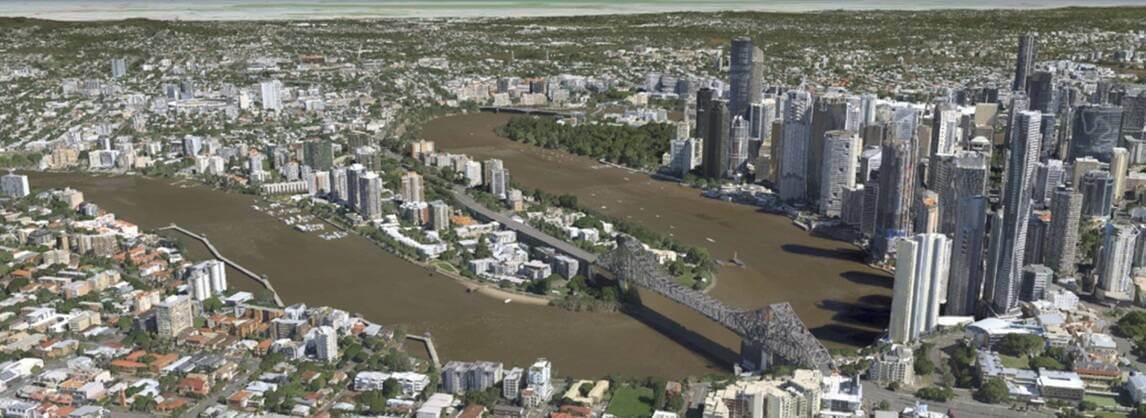
Vexcel Data Program announced 3D Cities, its newest product line covering key urban areas worldwide. Leveraging Vexcel’s high-resolution aerial imagery and geospatial data, these ready-to-use 3D digital twins offer super-detailed and realistic city views for customers in government, telecom, architecture, construction, and utilities.
Vexcel is launching more than 60 3D Cities on four continents, including Berlin, London, Los Angeles, New York City, Sydney, Tokyo, Vancouver, and Vienna. Customers can fly through immersive and accurate 3D cityscapes at scale, every commercial building, road, and property is mapped from city centers to residential neighborhoods.
“More than ever before, 3D models have become essential across multiple industries when it comes to design, planning, and analysis,” said Erik Jorgensen, CEO of Vexcel Group. “We’ve expanded our aerial imagery coverage globally and now our highly accurate imagery supports the production of 3D models to deliver information on a whole new level and scale.”
For example, the 3D model of Sydney, Australia covers 897 km2 (346 mi2), stretching from the Central Business District and the Opera House to the outskirts of Watsons Bay, Bundeena, Heathcote, and Guildford. “Our new 3D City models cover larger areas and are more geometrically accurate and detailed compared to other 3D products on the market,” Jorgensen added.
The models consist of a 3D textured mesh packaged in the 3D Tiles OGC Community Standard created by Cesium, a flexible, open-source format that allows customers to adapt, integrate, and interact with their 3D data across many platforms to meet the needs of any workflow. It also lends itself to customized 3D visualizations and is directly compatible with popular tools and platforms commonly used for 3D integrations. Vexcel’s 3D data is optimized for high performance and is off-the-shelf ready with no production turnaround time needed.
Examples of how multiple industries could benefit from this information include:
· Architecture, Engineering, Construction – planners can enhance their visualization, perform viewshed analysis
· Telecom – network designers can map clean lines-of-sight to simulate the propagation of radio signals and identify the best locations for antennas and base stations.
· Entertainment – video game designers can create and enhance animation design, support virtual tourism and immersive virtual and augmented reality applications
· Government – city engineers can use these digital twins for smart city planning and visualize the impact of natural hazards on city infrastructure and urban development
· Utilities – planners can use for asset management, demand forecasting, and the distribution of electricity, water, gas, and other utilities
· High-definition maps/fleet management – map engineers can verify building locations to map expanding neighborhoods, support more accurate autonomous vehicle mapping
Vexcel plans to add more 3D cities and metro areas based on customer demand. To learn more about this product and see the full list of available cities, visit this link.
Subscribe to our newsletter
Stay updated on the latest technology, innovation product arrivals and exciting offers to your inbox.
Newsletter

