COMIT annual conference – Mobilising Digital Assets
24th April 2017
COMIT annual conference – Mobilising Digital AssetsNews as it happens! Keep in touch with the latest developments in business and technology in the regions or worldwide.
24th April 2017
COMIT annual conference – Mobilising Digital Assets24th April 2017
The Global Space Exploration Conference - GLEX201721st April 2017
FIG Working Week 2017 - register before the deadline 25 April21st April 2017
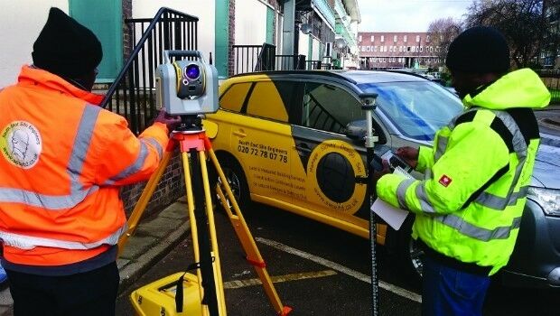
Environmental Data Collection & the Need for Speed21st April 2017
New GNSS receiver boards with expanded constellation tracking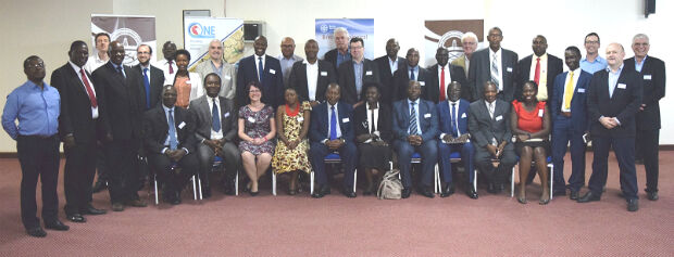
20th April 2017
Geodata access for African resource development20th April 2017
Tom Gmerek Becomes Social Media Manager at Quarry One Eleven20th April 2017
HERE, MediaTek team up to deliver advanced global positioning solutions20th April 2017
CARIS Hydrographic Production Database for Swedish Maritime Admin.19th April 2017
Space Flight Laboratory (SFL) at IAA Berlin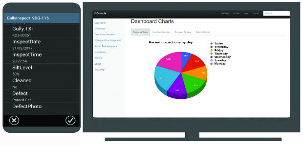
19th April 2017
K-Gully a hosted gully cleaning management system for contractors.
19th April 2017
GeoPlace annual conference – “Why I hate addresses” and all that19th April 2017
OGC seeks comment on proposed GeoScience Domain Working Group19th April 2017
Mutoh to Introduce A2-size Flatbed LED UV Printer19th April 2017
EarthCARE: Japanese Cloud Radar meets its spacecraft for first time19th April 2017
Autonomous Vehicles – have we reached the end of the road?19th April 2017
MNSAT: IFGICT to work with KSF Space Mapping to protect environment19th April 2017
Blue Marble Releases Geographic Calculator 2017