
SuperSurv Selected by Agricultural Company Socfinco
19th April 2017
SuperSurv Selected by Agricultural Company SocfincoNews as it happens! Keep in touch with the latest developments in business and technology in the regions or worldwide.
19th April 2017
SuperSurv Selected by Agricultural Company Socfinco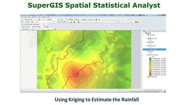
19th April 2017
What’s New in the Next SuperGIS Spatial Statistical Analyst18th April 2017
Towards a Spatial Knowledge Infrastructure White Paper Released
18th April 2017
Mike Osborne Wins AMSI Council Business Person of the Year 2017 Award
18th April 2017
Distribution of WorldView-4 satellite imagery in Europe begins
18th April 2017
3D Repo Cloud Platform adds Integrated Virtual Reality
18th April 2017
Pointfuse Transforms Design of Construction in London18th April 2017
Trumbull Unmanned Using SimActive for Emergency Response
18th April 2017
USGIF Confirms Keynotes for the GEOINT 2017 Symposium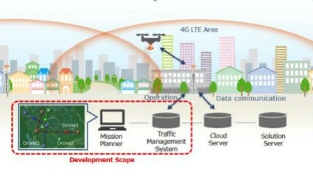
14th April 2017
KDDI and Terra Drone announce the invention of “4G LTE control system
13th April 2017
Global push for Earth observations continues13th April 2017
adsquare to enrich its advertisers platform with HERE location data13th April 2017
USGIF Launches Initiative to Grow GEOINT Workforce in St. Louis
13th April 2017
thinkWhere appoints Jumpstart's Brian Williamson as chair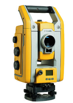
13th April 2017
Millimeter Accuracy for Monitoring Applications13th April 2017
GeoSmart adds Ambiental data to enhance its Flood Risk Assessments
13th April 2017
EarthSense Show Trees are Most Cost Effective Way of Tackling Urban Air Pollution
12th April 2017
Leica iCON now integrated in Liebherr LIPOS®
12th April 2017
Vertical Images: from film making to inspection12th April 2017
Ordnance Survey invites you to have a Wild Night Out
12th April 2017
Ecometrica lands on FT1000 list of Europe's fastest growing companies
12th April 2017
KPF Joined by HOK, OS and Unit9 for Third British Information Modelling Event