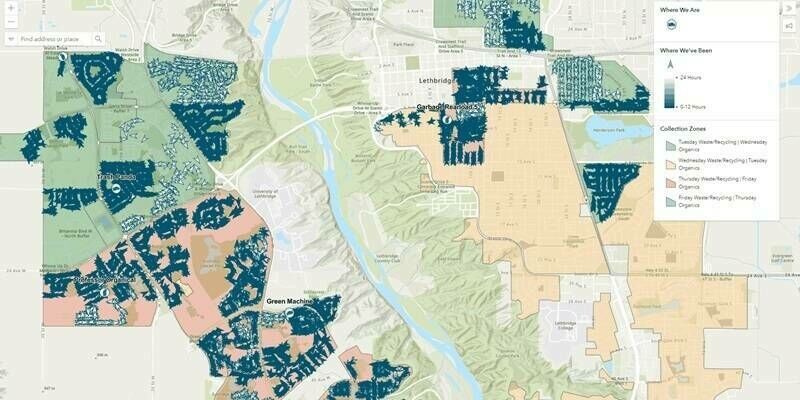
CompassAVL Puts Municipal Fleet Operations in Public View — Driving Transparency, Safety, and Efficiency
13th August 2025
CompassAVL Puts Municipal Fleet Operations in Public View — Driving Transparency, Safety, and EfficiencyNews as it happens! Keep in touch with the latest developments in business and technology in the regions or worldwide.
13th August 2025
CompassAVL Puts Municipal Fleet Operations in Public View — Driving Transparency, Safety, and Efficiency
13th August 2025
GeoTech Overseas Deploys UltraCam Osprey in Saudi Arabia
10th August 2025
Orbbec Debuts Industry-First Multi-Pattern 3D LiDAR at World Robot Conference 2025
10th August 2025
Scaling New Heights: Linkfast Techology Company Uses RIEGL VZ-600i to Deliver Fast, Precise Laser Scanning of the Taipei Dome
8th August 2025
Bright Lights, Bold Flights: RIEGL LiDAR is Flying High at the 2025 Commercial UAV Expo in Las Vegas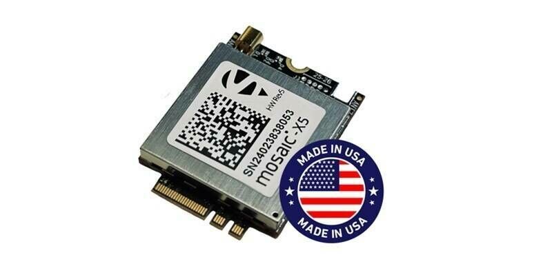
8th August 2025
Septentrio teams up with Gateworks, broadening its mosaic ecosystem
7th August 2025
Open Cosmos kicks off first Rideshare mission for the European Commission’s IOD/IOV programme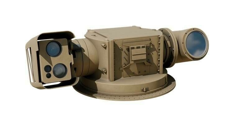
7th August 2025
EOS secures order for High Energy Laser Weapon System for counter-drone warfare
6th August 2025
Esri, Microsoft, and Space42 Join to Launch “Map Africa Initiative”
6th August 2025
Managing Large Photogrammetry Projects Simultaneously: Can It Be Done?
5th August 2025
HawkEye 360 Appoints David Wajsgras to Board of Directors
5th August 2025
Bjørn Ladegård appointed Executive Vice President of Nortek
4th August 2025
Congressman Salud Carbajal Explores Thermal Imaging Innovation at Teledyne FLIR OEM
4th August 2025
APEX Technologies, a Division of McCoy Construction & Forestry, Named Newest Trimble Technology Outlet
1st August 2025
Fugro partners with SDG Data Alliance to strengthen climate resilience in the Caribbean
1st August 2025
Eycore and Kongsberg NanoAvionics to collaborate on next-Gen SAR satellites for NATO and allied defence applications
31st July 2025
Stream wins global Esri award for geospatial innovation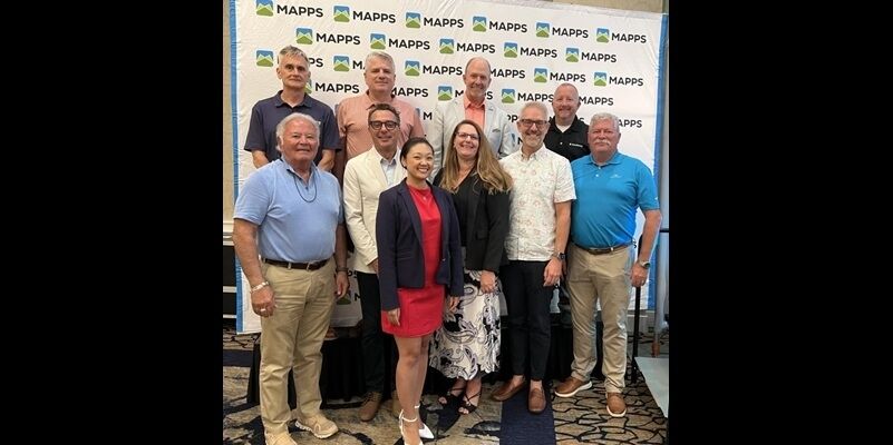
31st July 2025
RIEGL USA’s My-Linh Truong Re-Elected to MAPPS Board of Directors
30th July 2025
HawkEye 360 Launches Advanced GNSS Interference Detection Capabilities to Enhance Defense and Intelligence Operations
30th July 2025
SFL Missions Awarded Contract for Fast-Turnaround AISSat-4 Nanosatellite Development to Expand Capacity in Norwegian Maritime Monitoring System
29th July 2025
Catalonia to launch Europe's first 6G low-orbit satellite laboratory by the end of the year
29th July 2025
NAL Research, SGM Technology AS, and Tschudi Shipping Company Partner to Deliver Resilient Navigation and Tracking Solution for Commercial Maritime Vessels
29th July 2025
GMV developments key for Galileo’s new authentication service
29th July 2025
OME2 adds five new countries to final release of Open Cadastral Map