Share
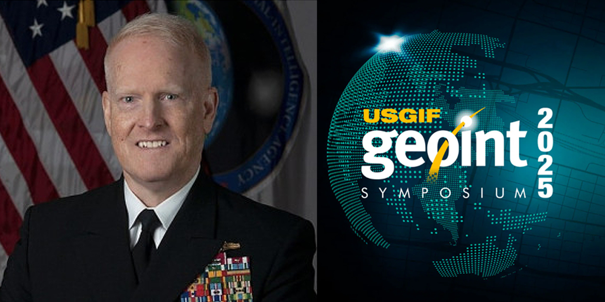
Remarks as delivered by Vice Admiral (US Navy) "Trey” Whitworth, Director, National Geospatial-Intelligence Agency, at this week’s GEOINT 2025 Symposium in St. Louis, MO
Good morning, team – good morning, St. Louis. You may recognize that riff from Van Halen’s 1981 “Unchained.” What a day to convey NGA’s unchained approach to new adversaries, new challenges, and new technologies.
Thank you, Yvette. That was such a nice introduction. And I’ll cite AWS as a reference in a few minutes. I want to thank in advance to Sue Gordon for leading our panel – from one Duke Blue Devil to another – I speak on behalf of all GEOINTers in thanking you for your continued advocacy of our tradecraft.
Thanks also to Director of National Intelligence Gabbard for taking the time to come out to St. Louis this week, to address the geospatial community, and to visit NGA’s new campus in north St. Louis on Monday.

We continue to think and pray for all people affected by last Friday’s tornado. Our new building, less than a mile from that tornado’s path, can be emblematic of this city’s perseverance and resilience – standing tall as America’s newest intelligence center here in the heartland. I so look forward to our opening this new nerve-center on September 26th.
Thanks to everyone at USGIF – for all they do for the community year-round, and for assembling yet another world-class GEOINT Symposium.
Thanks to the Chief of Space Operations and our teammate, General Saltzman, for being here today. NGA and the United States Space Force are aligned and committed to our roles across Title 10 and Title 50. We collaborated for months to establish a new Memorandum of Agreement (or MOA) – and we just signed it today – which accelerates the relationship we already have and leverages GEOINT Functional Management to take TacSRT to the next levels of speed, scale, and trust. That MOA is more than a step in the right direction…it is foundational.
Synchronised approach
NGA also appreciates Space Force’s joining us in a synchronized approach to commercial GEOINT – by partnering with us on our “all of government” approach to tackling our most difficult challenges in a cost-effective way.
The bottom line here is this: The Space domain is vast and critical to our nation’s security. NGA and Space Force have the right people, with the right skills, working together to tackle current and emergent requirements.
Space is not a new mission area for NGA. Look to the 1960s, for instance.
Everyone knows the efforts of NASA engineers and astronauts during the Apollo missions – their feats are legendary.
But as for charting the surface of the Moon, it was two of NGA’s predecessors – the Aeronautical Chart and Information Center right here in St. Louis, and the Army Map Service – who drove a massive cartographic effort to map the lunar surface. It was those efforts that led to determining lunar orbits, planning lunar landing sites, and ultimately, the first manned lunar landing in 1969.
Bottom line, again: NGA has the experience, expertise, and innovative spirit to help keep the United States of America on top of the Space domain.
Today, I will address three topics:
1. Highlight some of NGA’s accomplishments since we last met.
2. Highlight this year as the “Year of AI” for NGA.
3. Address the future of NGA and GEOINT, and how the GEOINT community can help build a secure tomorrow together.
FIRST TOPIC: ACCOMPLISHMENTS SINCE LAST GEOINT SYMPOSIUM
So, let’s begin with a review of NGA’s accomplishments since the last Symposium.
NGA’s raw and finished intelligence – and GEOINT writ-large – have been at the forefront of intelligence on crises and national security challenges around the globe. Throughout this last year, the quality of our work has been extraordinary and in high demand. The timeliness and relevance of our products with Cabinet-level readership continued climbing this year – sustaining a nearly eightfold increase in key publication rates over the three years I’ve been Director – as the world continues to bring new, compelling material. From the Middle East to the Korean Peninsula; from the Black Sea to the Southern Border of the United States; and from hurricane, flood, tornado, and wildfire-ravaged areas of the U.S. to the South China Sea, the expertise and commitment of NGA’s GEOINT professionals have been mainstays for warfighters, policy makers, and first responders.
The volume of GEOINT reporting … compared to reporting from all the other intelligence disciplines in fulfilling consumer needs … is way more than most people would ever expect.
It’s even more than most GEOINTers think it is. Let me give you a few commercial statistics, provided by AWS – and these are unclassified. NGA stores more than 290 petabytes in the AWS Cloud – comparatively, that’s more data than ALL other Intelligence Agencies,
Combat Support Agencies, etc. Our expertise in compression and use of Glacier makes us the “most storage-optimized” agency in the IC. In AWS classified regions, we are also the largest user of the latest generation of NVIDIA H100 GPUs. Simply put, NGA is in the top one percent of AWS storage users…period.
Working 24/7
That data and exploitation are meaningless unless they address the right collection at the right time. There is a symbiotic relationship between our analysts and our collectors – as we work 24/7 on ensuring a predictive and time-sensitive approach to collection – a process we call “informed collection orchestration,” choreographing an increasingly complex and capable constellation of space-based GEOINT assets.
The process is central to ensuring our warfighters, decision-makers, and intelligence professionals receive the GEOINT advantage we all demand – at location, on time, and accurately. While we’ve received glowing marks via USD/I&S from the Combatant Commands regarding our commercial and national collection satisfaction rates, we also let the data do the talking…assessing our collection rates daily and our adherence to the Nation’s priorities and warfighting readiness.
At our core…warning, targeting, and safety are what we do, but how we do it is equally important ...we do it with Objectivity and Efficiency. In today’s world, both are essential.
Every morning, I have the privilege to witness our analysts’ and collectors’ expertise as we review overnight developments. I will assure you: we call them as we see them. Like the umpires just down the street at Busch Stadium: we call balls and strikes – pure objectivity.
We also do it with efficiency. We are among the smaller agencies. With no hesitation, I can say that pound for pound – dollar for dollar – NGA (and the GEOINT enterprise, by extension) punches way above our weight. On a near daily basis, we hear from our consumers that we are in the game, every day, in every hot spot. I hope you can sense the pride I have in our team.
Allow me to give you a few examples. When it comes to the US Indo-Pacific Command area of operations, China is our most consequential opponent in strategic competition. NGA plays a key role in monitoring Chinese activity across the globe, including the Taiwan Strait, as well as illicit and illegal activities undertaken by China all over the planet.
China’s – and Russia’s – space activities have become increasingly concerning, with both countries deploying progressively capable systems aimed at direct competition with the U.S. and our space-based systems. Both countries have deployed ground-based counterspace capabilities, including electronic warfare systems, directed energy weapons, and anti-satellite missiles.
Renewed focus
The Commander-in Chief’s priorities are also driving a renewed focus in the Western Hemisphere. Quickly and unflinchingly, we stood up a Southern Border Task Force, and deployed personnel in support of the Department of Homeland Security and US Northern Command.
Our Source Directorate’s Office of Geography has been supporting that mission by producing 7500 new maps that now provide 100% coverage of Latin America – and they did that within 8 weeks of the initial requirement being communicated. Thanks to automation, that rate of cartographic accomplishment has never been matched.
Before recent AI efficiencies were available, under our previous system, it would have taken approximately 2 months per map to complete the mission.
But through the new map production automation tools that NGA developed, we can now deliver a safe, usable, and readable map … in 20 minutes.
Let’s put that in perspective – under our previous map production process, to produce the 7500 maps we created, it would have taken 7 and a half years. We did it in a little over 7 and a half weeks.
And that speedy team … is right here in St. Louis.
And in coordination with US Southern Command, NGA developed the Enhanced Domain Awareness tool, to monitor illegal and unregulated fishing – which circles right back to China.
Of course, we also remain very involved with US European Command and US Special Operations Command, especially with respect to the war in Ukraine, and we’re closely monitoring the situation in Gaza, which lies at the nexus of USEUCOM and US Central Command responsibilities.
From seabed to space
But I’d like to turn back now to Space, and how we tie into US Space Command. Because NGA relies on the warfighting domain of Space, and the warfighting domain of Space relies on NGA. Many of you, I’m sure, remember that about two and a half years ago, we changed our motto to add “from Seabed to Space,” and it was the right thing to do – to remind people that we're not just concerned with the Earth, we’re also focused on the domain of Space itself. We have winning relationships with our Space partners – specifically the U.S. Space Force, USSPACECOM, and the National Reconnaissance Office.
The future of these relationships is bright, in part because of the innovation going on in our Joint Mission Management Center – in our headquarters in Virginia. It's now at Initial Operating Capability, and there are Space Force Guardians working with us – patriots who task satellites to ensure that we know the entire denominator. The JMMC is what collaboration looks like. Together, before any pixel or analysis is bought, or any task is rendered, we make sure that as good stewards of taxpayer money, we're not paying twice.
Commercial GEOINT
We all know that Commercial GEOINT is even more essential these days, as government looks to the private sector for faster innovation. Like others in the Defense Department, we’ve recently been using Commercial Solutions Openings that were pioneered by the Defense Innovation Unit – CSOs for short. They’re basically pre-vetted relationships that let us move very quickly if something appeals to our mission. We’ve employed the CSO Project Aegir for maritime domain awareness in the U.S. Indo-Pacific Command area, and it’s afforded us much better speed than we’ve had in the past.
We also have been successfully incorporating bailments along the way. Bailments are no-cost agreements that enable NGA to test, evaluate, and analyze a product, analytic service, or analytic solution to determine how it performs – basically, to “test drive” a solution for use – all before an actual requirement comes in. We’ve had 53 bailments since we began in 2018.
More than a dozen of these have transitioned to a contract or CRADA. Bailment agreements can be set up in two weeks and are a great way for new businesses to get in the door.
And, last year, I announced our 200-million-dollar Luno B contract. And it’s going well – 13 companies are providing commercial GEOINT data and services. I’ll have more news on that later.
To stay on the commercial subject, NGA leads a community-wide process to coordinate commercial GEOINT purchases across the government, maximizing our ability to share commercial imagery and analytics and preventing redundant acquisitions. NGA provides the Services, Combatant Commands, interagency, first responders, warfighters, and international partners access to commercial imagery through a web-based service known as Global Enhanced GEOINT Delivery (G-EGD). With over 400,000 G-EGD users, NGA delivered more than 325 million unclassified images to missions across the whole of government in 2024 alone.
Moving to the edge
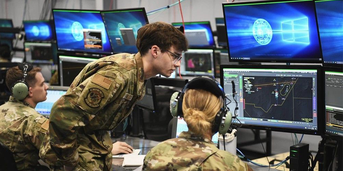
Here in this room, many of you are familiar with the Joint Regional Edge Node – JREN for short – and the GEOINT Information Management Systems – GIMS – we’re focused on the slimmed down version these days, so SlimGIMS. They’ve both been developed to help us rapidly and efficiently move imagery and data to the edge, in support of analysis and targeting needs in austere environments.
In the VALIANT SHIELD and TRADEWINDS exercises last year, we held two successful tests of JREN and a test of SlimGIMS – that all fulfilled the Combatant Command requirements to task satellites in theater with a simplified user interface. So, not only did they meet the capability gap, but they also reduced the time to create a collection request from 60 minutes … to FIVE. NGA will be conducting two additional SlimGIMS tests this year, so stay tuned for more good news there.
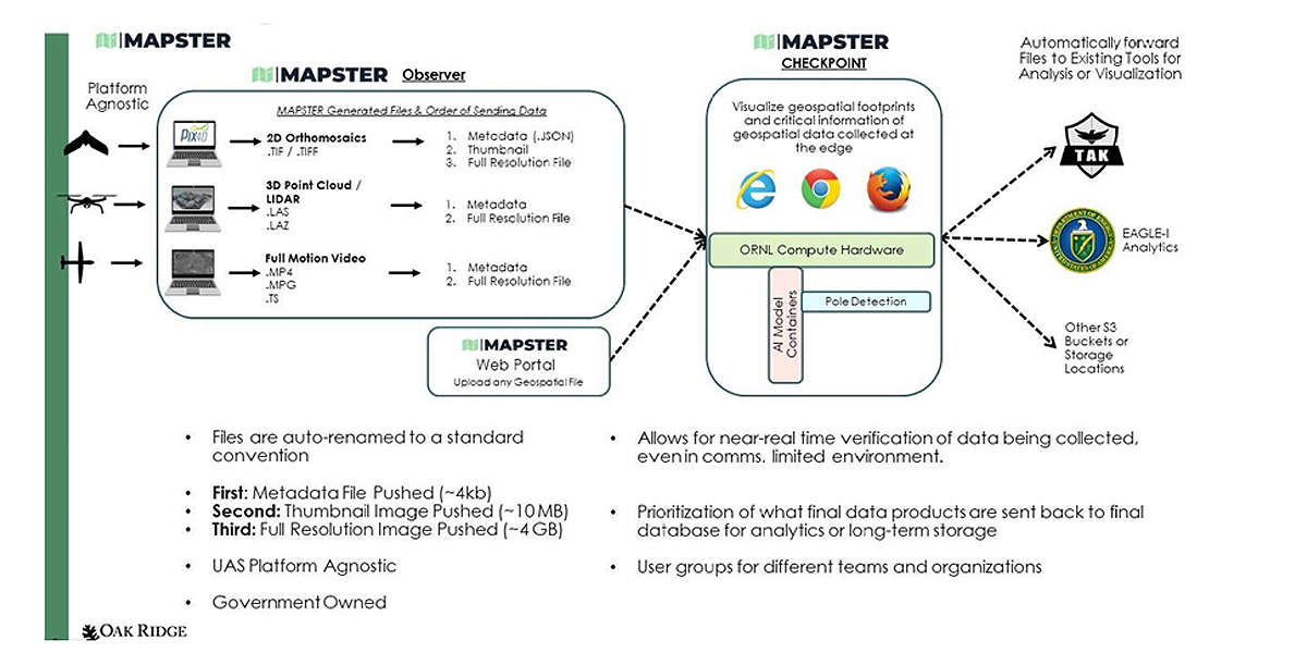
We also recently had some teammates travel to the Joint Multinational Readiness Center in Germany for Exercise Combined Resolve – which was all about preparing a multinational brigade to support NATO deterrence initiatives. The team worked with the 10th Mountain Division, and they used MAPSTER, which ingests native unmanned aerial system imagery and provides unclassified data sharing and dissemination at the edge.
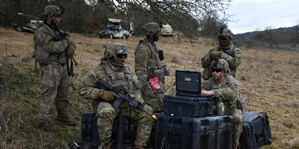
And then there’s the GEOINT AI/ML Light-Edge Resilient System – or GAMBLER – which creates and integrates unclassified AI detections at the edge, providing warfighters from the brigade commander … down to platoon members … with enhanced situational awareness of static and dynamic elements. Best of all, it conveys that operational picture over handheld devices that are connected to tactical radios.
To better describe these innovations, MAPSTER is used to gather still imagery and full motion video that’s been collected by sensors on Unmanned Aerial Systems – UASs – into a central repository, where the data is downloaded for further exploitation. GAMBLER brings forth the ability to create new models in the field for automated imagery processing – it’s hours or days, instead of months, to train the system on a unique model which is specific to warfighter needs.
Exceeding expectations
Anyway, our team exceeded everyone’s expectations with rapid and successful demonstrations of the agility and adaptability of this tech into the unit’s organic architecture. MAPSTER and GAMBLER have also gone out to the 25th Infantry Division to support U.S. Indo-Pacific Command, the 18th Airborne Corps’ Scarlet Dragon exercise, the 1st Armored Division at the Army’s National Training Center, the 3rd Marine Littoral Regiment for Exercise Balikatan in the Philippines, and they’ll go again in the TRADEWINDS program in July in the Caribbean to help improve readiness and deterrence for U.S. Southern Command.
We’ve also enjoyed great partnerships with academia this last year, and I have a great example. NGA Unclassified Data Lake, or NUDL for short, is supporting two major academic initiatives that focus on the next generation of GEOINT professionals. Students are using the NUDL platform as their primary tool for GEOINT analysis to analyze imagery, and to derive data-driven insights for their projects.
Besides Industry, academic, and government partnerships, we also have many great international partnerships. There is no time to cite them all – so I’ll offer one example, and that is Bahrain. Last December, we announced our ambitious Geospatial Acceleration Initiative together. It stems from the advanced technology track of the Comprehensive Security Integration and Prosperity Agreement that both our countries signed several years ago. So, we’re now collaborating to produce and share hydrographic, aeronautical, and topographic geospatial data. It’s all designed to enhance Safety of Navigation for our forces in the Red Sea and the Gulf of Aden.
NGA remains fully engaged in supporting Humanitarian Assistance and Disaster Relief missions that have impacted the United States by providing Collection Orchestration for Lead Federal Agencies responding to natural disasters.
Specifically, NGA was responsible for wildfire mapping support to the National Interagency Fire Center that resulted in over 600 requests for mapping support covering 82 separate wildfires in 19 states to assist firefighters at the state and local level.
This includes support to the wildfires that affected Los Angeles back in January of this year.
During the 2024 Hurricane Season, NGA provided support to the responses to both Hurricane Helene and Hurricane Milton with deployable GEOINT capabilities, collocated with Federal, State, and Local Urban Search and Rescue first responders.

What a year… and frankly, I’ve cited just the tip of the iceberg!
SECOND TOPIC: YEAR OF NGAI / ORGANIZATION
That brings us to our second topic…
At the beginning of 2023 and 2024, we had themes around which to coalesce our efforts. Those two years were NGAccelerate and NGAction. This year, 2025… is the Year of NGA - AI.
While we’ve treated AI with the care and power it deserves – we’ve entered into an “unchained phase” by implementing a whole-of-agency approach to AI transformation. And we see that action paying off across the board.
For instance, we apply AI and Machine learning to our marquee targeting program of record, NGA Maven – and by extension, to our major system acquisition for imagery workflow, NGA Aspen. We embrace the speed and scale AI brings to our tradecraft – and so do our warfighters and readership.
One of them is the 18th Airborne Corps at Fort Bragg.
While the time-critical targeting cell in Operation Iraqi Freedom (or OIF) has long been considered as the benchmark in efficiency in U.S. military history, the team at Fort Bragg recently used NGA Maven and Maven Smart Systems to match and even exceed that performance. Because while the OIF targeting cell had more than two thousand people, our team achieved that milestone … with 20 members.
1,000 high-quality decisions in an hour
NGA Maven is now available to all Services and all Combatant Commands. There are
currently 20,000 active users through more than 35 service and combatant command tools, across three security domains. The user-base has more than quadrupled since March of last year, and more than doubled just since January. Army leaders, specifically, are trying to leverage Maven to meet a new vision for units to make a thousand high-quality decisions – choosing and dismissing targets on the battlefield – in one hour.
NGA Maven has decreased targeting workflow timelines by a substantial amount, with one warfighting element’s targeting cell seeing intelligence-operations timelines drop from hours to minutes from sensing to target engagement during a recent exercise.

Stats like that are important. We all want a report card, and it’s useful to get metrics. In targeting, there’s nothing more vital than being able to distinguish combatants from non-combatants – and adversaries from non-adversaries. And the best way to measure what kind of a year you're having … is to measure how quickly you're running inference and getting to that conclusion or prediction.
We take this very seriously, and even with high-tech help, it requires humans to train the machines to ensure that they’re right. When we send the data that comes from collection through these models, we run the inference in the computer vision process that yields detections. And to add to that, the latency of our models – our time lags in running inference specifically – has improved 80-percent in the year since NGA Maven became a program of record.
So, we’re willing to put our money where our mouth is. At NGA, we’re leveraging AI to help sift through the millions of detects we get a day and are also starting to train the best industry models on the corpus of NGA reporting.
We’re also leveraging it in our business processes, to ensure we’re operating as efficiently as possible. Communications products are beginning to utilize the power that these models are harnessing, and we’re going to be better for it. As always, we want to let the computers do their thing, so the humans can be better at ours.
Ethical AI
I spoke last year about our GEOINT Responsible and Ethical AI Training, or GREAT. Last August, we announced our commitment to a first-of-its-kind effort to develop community standards around our model creation. We called the pilot the “Accreditation of GEOINT AI Models” – or AGAIM for short. As the vanguard of distinction, NGA has a responsibility to set standards the uphold positive identification (or PID) – as ensuring PID is the prerogative of the Commander-in-Chief, Secretary of Defense, and their delegated engagement authorities. In our business, trustworthiness and reliability are essential for accurate and consistent outputs – and for minimizing the risk of catastrophic errors in high-risk environments. We accredit GEOINT AI models to enable decentralized innovation – and we will work hard to make the process swift and repeatable…not like an onerous authority-to-operate.
Since the launch of that AGAIM pilot, we’ve leveraged our legal and ethical AI standards, applied rigor to develop and establish criteria for the NGA model card, and today, I can proudly announce that we’ve now accredited two GEOINT AI models.
Those accreditations – one used by our own NGA Maven and the other developed by an IC partner – beget an open invitation for members of the GEOINT community. As we standardize this process and train trainers, we encourage you to seek AGAIM – to seek assurance that the models will operate with integrity and precision, and with security compliance.
I’d now like to turn to our progress on machine learning and natural language processing. That’s what enables the automated sifting, sorting, translating, comprehending and sensemaking of billions of words to make inferences about image and text data.
For example, A2SoN – Analyst Assisted Safety of Navigation – enables faster and more accurate analytical decisions about the status of port infrastructure features. What we do is scrape unstructured data from commercial imagery, notices and messages, maritime periodicals, port websites, and our own sources. Then the A2SoN auto-processes text and imagery sources to accurately identify features and events – which has led to 90 percent shorter data prep times.
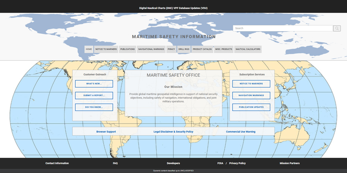
Related to that is the Source Maritime Automated Processing System, or S-MAPS. Compared to earlier manual methods, S-MAPS reduces processing timelines and broadcast preparation by about 65 percent. Our Maritime Safety Office now categorizes 1,100 automated messages a day, with 35 percent fewer data entry errors, and a shortened learning curve for analysts.
And before I move on, I want to get a few things on your calendars – and you can sign up for them both on Intelink.
First, on June 9, NGA is hosting our first GEOINT AI Industry Day at NGA Washington, and then on November 20 and 21, I invite you to the GEOINT AI Summit, also at NGA Washington. These two events are designed to foster the right conversations and collaborative environment that we all need to drive GEOINT AI into the future.
Because while 2025 is the Year of AI, 2026 is going to take it to another level. Let’s all be a part of it.
THIRD TOPIC: FUTURE OF NGA AND GEOINT
For my third and final topic, let’s pivot to what’s next, and talk about where we would engage with the broader GEOINT community.
With an ever-increasing deluge of data, I ask you all to think about how you fit in, drive technology, and engage across National Technical Means, which is best in class, of course. I want you to think about an emerging constellation called the proliferated architecture, which is where the U.S. Space Force has been instrumental in leadership. And think about commercial collection out there. Think also about what our international partners might be able to contribute. That's the entire denominator that ultimately leads to our good problem of deluge.
But as we get additional data, and we run additional inference with different types of models for different situations, even with likely improvements in latency, we're most likely going to have some challenges when it comes to compute.
So computational power is very, very much the buzz, and it’s definitely one area where Industry can make a difference.
We’ll continue to exploit and store more 1’s and 0’s than any other U.S. Government agency.
With the size of constellations growing, and the number of terabytes coming from Space over the next seven years, that data collection will go up precipitously – so, too, must our computational power in order to keep our edge in latency and accuracy.
There are a few things coming soon I’d like to mention, too...
Impact of multimodal
If you’re not that familiar with the term “multimodal” yet, it’s basically taking several layers, and ensuring that a model can actually translate a computer vision solution to what might be something in text. And multimodal’s impact on our readiness is going to be key. We have at least three multimodal tests going on right now, and they’re actually demonstrating that this is going to make a difference in our speed and the completeness of positive identification, which will in turn help us with analysis – particularly in targeting and warning. It will help us indirectly with our collection and our tasking – this in light of that left-hand/right-hand relationship we discussed between analysis and informed collection orchestration.
We have to be correct. This is a no-fail mission when it comes to warning and positive identification. Multimodal foundation models are already enhancing our speed and confidence – stay tuned for more progress.
Before wrapping up, I want to bring up something that I spoke about right here at the GEOINT Symposium two years ago.
Reluctant revolution
It’s the idea of a Reluctant Revolution in Military Affairs, or RMA. The concept that operationally, our warfighting undergoes changes, enhancements, or theoretical pivots. My point two years ago was that we were in the midst of a “reluctant” iteration of that cycle, since we were now largely fighting our conflicts remotely, or “here,” rather than “over there,” which is where any warrior worth their salt – on any side of any conflict – historically, would really want to be. In an academic piece, I subsequently named this RMA “Drones, Codes, and Spacecraft” – specifying that the reluctance isn’t directed at Codes and Spacecraft (witness the presence of two combatant commands and an entire Service.)
The story of drones, though, and their proliferation in warfighting readiness is an unfinished tale – and we have only begun GEOINT AI’s integration into this compelling challenge. NGA is demonstrating that AI and automation tools are not just here to help, they’re here to stay, and are a part of how we will live and breathe, as we continue to work at pace, to keep our Nation safe, and our freedom close at hand.
Before closing – we have three pieces of GEOINT business news to make…
First – Luno A Task Order 3 for $13.8 million was awarded this week to Ursa. The Global Oil Awareness Tracker - or GOAT for short - will provide unclassified, commercial GEOINT analytics of petroleum-based production and storage facilities
Second – Yesterday, NGA awarded $25 million for High Performance Computing to the University of Illinois, a member of the Taylor Geospatial Institute. This work will support NGA’s strategic partnerships, advanced AI and machine learning, logistics for data production on a global scale, and integrated tipping and cueing strategies.
And third – Palantir was recently awarded a $28 million contract to expand access to Maven Smart System for NGA analysts, and to provide capabilities that assist with analytic modernization efforts.
OK, time to bring this back full circle. Earlier, I spoke about St. Louis and its place in lunar exploration. It has long held an exceptional place in discovery and exploration. It was the launch site for Lewis and Clark and the Corps of Discovery that mapped the western United States.
And 98 years ago today, the world got smaller when Charles Lindbergh landed a custom-built, single-engine, single-seat plane – The Spirit of St. Louis – in Paris completing the first solo trans-Atlantic flight in the history of the world.
On that historic trip, he faced icing, thunderstorms, fog, and exhaustion. At times, he flew just 10 feet above the ocean.
On that flight, he carried one chart with him – one made by the U.S. Hydrographic Office, another NGA predecessor agency – that guided him to one of the greatest feats of the 20th Century. The modern-day versions of aeronautical and maritime charts are produced right here in St. Louis.

Besides Lindbergh and The Spirit of St. Louis, this amazing city is renowned for great music, award-winning BBQ, and passionate sports fans.
But recently, a lot of people are starting to add “geospatial” to that list.
Mapping a new future
Nine years ago, NGA announced that we would build a new campus in North St. Louis. It set into motion activities by civic and academic leaders that far exceeded any of our expectations. The St. Louis Post-Dispatch ran a prophetic headline the day after the announcement that read, “NGA Maps a New Future.”
NGA and its predecessor agencies have been ingrained with this town since World War Two, and it’s where we plan to call home for the next century.
And today, our agency is driving technology and innovating our tradecraft in ways we could only dream of, even at the dawn of this millennium. In many ways, this is the Golden Age of GEOINT, led by many in this room – inspired by increasing advancement in our capabilities – including the promise of Artificial Intelligence.
Let’s close this morning with Charles Lindbergh. When The Spirit of St. Louis landed in Paris in 1927, something called “the Lindbergh Boom” came into being.
By the end of that year, applications for pilots’ licenses tripled, the number of licensed aircraft quadrupled, and by 1929, U.S. airline passengers increased by 3000 percent, with dozens of companies forming to create airlines. It was a new age for aviation.
Even in the face of economic and political upheavals, the boom continued and attempts to set new world records in aviation didn’t subside.
The Lindbergh Boom changed the world. It ushered in the future.
Timing is everything.
And there’s no doubt in my mind that the timing for GEOINT AI is now. It’s the key to building a secure tomorrow … together.
All right, I’d like to turn the rest of my time here into a conversation. I welcome the excellent questions that you’re about to hit me with.
Let’s all get a bit unchained with this pace of change. Thank you all so much for your interest in what we all hope to accomplish … together.
Story Source: NGA
Subscribe to our newsletter
Stay updated on the latest technology, innovation product arrivals and exciting offers to your inbox.
Newsletter

