Share
Ian Stilgoe highlights how the latest innovations from Topcon Positioning Systems are addressing labour shortages, cost pressures, and the growing demand for accurate, accessible data capture. Strategic collaborations are further expanding its capabilities across construction, surveying, architecture, and mass-market applications.
GeoConnexion (GEO): In March of this year, Topcon released the “Kui-Navi” LN-60, a specialised model of the Layout Navigator, designed for the Asian market. Could you discuss the challenges that the construction industry in Asia faces and how the LN-60 meets these?
Ian Stilgoe (IS): Two big challenges facing the construction industry in Asia are labour shortages and rising material costs – both of which require innovative solutions that will increase efficiency, reduce costs and adapt to changing demands.
With a shortage of skilled labour in the sector, the more accessible technology can be to operate, the greater the uptake can be and the more the sector can fill that gap. This is where the “Kui-Navi” LN-60 comes in. Its self-leveling function allows inexperienced users to easily set up and operate the device, reducing dependence on highly skilled workers and the need for extensive training. It also integrates with modern technologies and can be controlled via an Android or iOS device with the free "TopLayout" software, supporting multiple languages and making it more accessible to users across Asia.
There are improvements to efficiency too. The LN-60 provides ultra-fast data updates and real-time guidance, ensuring smooth and efficient staking and marking, which saves time and minimises errors. It’s also cost-effective and energy-efficient, providing up to six hours of continuous use per battery.
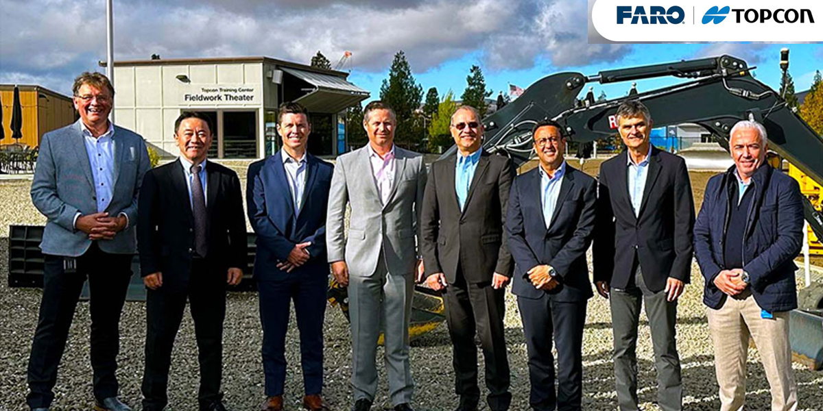
GEO: Last February, Topcon and FARO Technologies announced a strategic agreement in laser scanning technology. Through this agreement, FARO and Topcon plan to introduce initiatives to further the collaboration, including product offerings and enhanced software integrations. Could you discuss the results so far of this collaboration process with regards to laser scanning technology and how do customers react to the strategic announcement?
IS: The agreement focuses on advancing laser scanning technology by combining the expertise of both companies to offer innovative solutions. Through the collaboration, we aim to improve product offerings and software integrations, particularly in industries such as construction, surveying, cartography, architecture, forensics, and industrial applications.
A key aspect of the partnership involves seamlessly integrating Topcon and Sokkia solutions into FARO Technologies, providing users with more comprehensive reality capture solutions. Additionally, FARO's advanced reality capture tools are now more accessible through our established distribution channels. Both FARO and Topcon are dedicated to overcoming our customers' challenges, working together to enhance productivity, accuracy, and efficiency.
A significant development benefiting from this collaboration is the Collage software suite by Topcon, a central platform for managing mass data workflows. Collage Site software enables the real-time capture, processing, and visualisation of georeferenced point clouds directly on site. This eliminates the need for extensive back-office processing, enabling users to solve project problems on site as well as saving time and reducing costs. When combined with the CR-P1 laser scanner by Topcon, the software offers unparalleled precision and effectiveness, marking a milestone for professionals in construction, surveying, and architecture.
The global market has responded positively to this collaboration, recognising its potential to drive innovation and deliver significant value to professionals in various industries – something that is at the heart of what we do at Topcon.
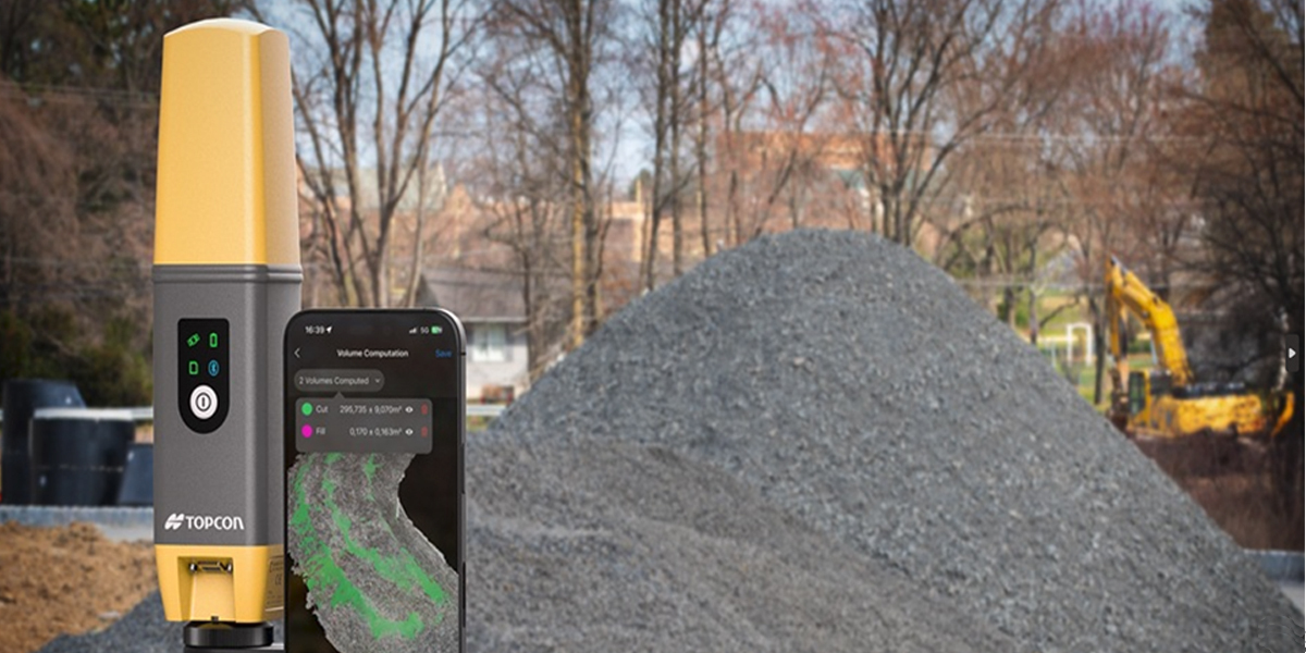
GEO: Topcon also launched the CR-H1 handheld reality capture solution. What has been the reaction of the market to this new release?
IS: There’s been a really positive response to the CR-H1, which is meeting the growing demand for accessible, high-precision reality capture tools. The CR-H1 combines advanced GNSS technology and RTK accuracy with our global correction data service, Topnet Live, and Pix4D's photogrammetry software. This combination offers professionals and new users an intuitive way to quickly and easily create accurate 3D models on site.
The launch underscores the rapid implementation of the strategic collaboration between Topcon and Pix4D, and demonstrates our shared commitment to innovation in 3D data capture.
GEO: How do you see the future for mobile phone-based scanning using LiDAR for reality capture applications? Do you foresee more application-specific product releases, or is one sufficient for a myriad of applications, such as the CR-H1 at the moment?
IS: LiDAR scanning with mobile phones has the potential to revolutionise reality capture applications and we have already seen the positive impact the CR-H1 and other solutions are having in the sector. However, there is a growing interest in customised solutions for highly specialised use cases. This tailored approach could enable greater efficiency and precision for users with specific needs.
We are working hard to expand our portfolio with innovative mobile scanning solutions. By doing so, we aim to support a broader range of applications and use cases, strengthening our position in mass data while delivering the tools that meet the evolving needs of professionals in the construction, architecture, engineering, and geospatial service industries.
The growing interest in mobile LiDAR scanners is driven by the increasing demand for efficient, accurate, and flexible data collection methods. Companies and industries recognise the unparalleled value of LiDAR technology in increasing productivity and improving decision-making. This makes the rapid development of advanced solutions a necessity, not just a possibility, and signals continued growth in this market for the foreseeable future.
GEO: In addition to this, what is your take on Gaussian Splatting and how does it compare with LiDAR scans in terms of accuracy?
IS: Gaussian splatting (3DGS) is a modern visualisation technique that uses Gaussian distributions to represent 3D point clouds instead of traditional methods such as point clouds or meshes. This approach produces smoother, more realistic visuals while significantly reducing the necessary data.
However, when comparing 3DGS to LiDAR scans in terms of accuracy, there are some key differences. Gaussian Splatting transforms point cloud data into Gaussian shapes, resulting in smooth, continuous surfaces. This makes it ideal for creating visually detailed models with smaller file sizes. LiDAR scans, on the other hand, capture raw point cloud data with high precision, making them ideal for accurate measurements and spatial analysis. LiDAR is more reliable for precise measurements and geospatial data collection because it directly records real-world dimensions. Meanwhile, Gaussian Splatting is less focused on measurement accuracy and more focused on creating visually appealing and efficient representations.
The applications of these technologies differ as well. Gaussian Splatting is best suited for industries such as gaming, architecture, and computer-generated imagery (CGI), where visualisation is a priority and survey data needs to be presented in an easy-to-understand format for clients. LiDAR, on the other hand, is better suited for technical tasks that require high accuracy, such as mapping, infrastructure inspections, and environmental studies.
There’s a clear place for both in the future: Gaussian Splatting is a powerful tool for making point cloud data visually engaging and efficient to work with, but LiDAR remains the preferred choice for tasks demanding precise measurements.
GEO: In 2024, u-blox and Topcon announced a collaboration set to create one of the world’s largest high-precision GNSS positioning service offers for the mass market. What have been the results of this collaboration so far and which markets/applications can benefit most from this collaboration?
IS: The collaboration between u-blox and Topcon is focused on developing one of the largest offerings of high-precision GNSS positioning services for the mass market. We are leveraging the expertise of u-blox in mass-market GNSS hardware and our own precision GNSS services to deliver globally available, reliable, and affordable GNSS correction services. These services integrate seamlessly with u-blox's hardware and solutions, such as PointPerfect Live, enabling centimeter-level accuracy for a wide range of applications, and PointPerfect Global, providing correction service global coverage.

The results of this collaboration are already delivering benefits to both Topcon’s and u-blox's customers, who now enjoy enhanced levels of service and affordability. The combined GNSS correction services cater to a diverse range of sectors including automotive, industrial, robotics, construction, agriculture, and mobility.
By combining our strengths, we have expanded our global reach and created scalable solutions that meet the needs of high-precision and mass-market applications alike.
GEO: Earlier this year, Topcon announced enhancements to the Topcon Collage Site. Can you explain how you make it easier for the user to capture, process, and visualise scan data in the field? How do you find a balance between extending functionality within the software and providing intuitive user interfaces so that user productivity is guaranteed?
IS: The latest improvements to the Topcon Collage Site software make it easier for users to capture, process, and visualise 3D scan data directly on site. Integrating the software with hardware such as the CR-P1 laser scanner or the GTL-1200 scanning total station allows users to create and view georeferenced point clouds in real time, reducing the need for traditional office processing. This instant access enables rapid problem solving and helps teams deliver accurate, complete project data from the beginning.
The rugged FT-100 tablet is the ideal device for this software. It is designed for use in harsh outdoor conditions and delivers the performance required for demanding data workflows. Its powerful processor, fast graphics card, and large display enable the real-time capture, processing, and analysis of scan data. This allows operators to work efficiently and safely in any environment.
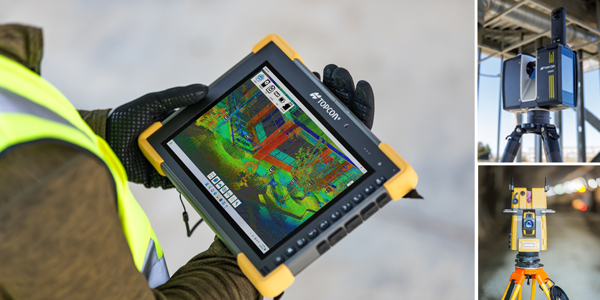
Collage Site stands out for its intuitive user interface, which allows both new and experienced users to take advantage of its advanced features with minimal effort to learn how to use them.
The interface clearly and logically organises important tools for data management and analysis, eliminating confusion and optimising on-site operations. But the benefits don’t stop there, with integrated tools for review and analysis, such as quality control and model creation, users can perform complex tasks on site, resulting in higher productivity and faster turnaround times. Rather than waiting for scans to be processed or analysed in the office, teams can immediately review results, collaborate to make adjustments, and avoid costly return visits to the site. The result is higher productivity, greater confidence in decision-making, and better quality data to inform decisions.
Ian Stilgoe, vice president, global emerging business at Topcon Positioning Systems
Subscribe to our newsletter
Stay updated on the latest technology, innovation product arrivals and exciting offers to your inbox.
Newsletter

