Share
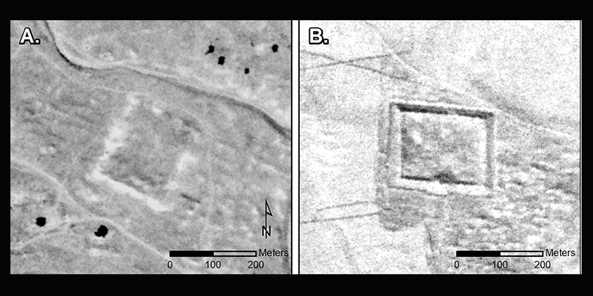
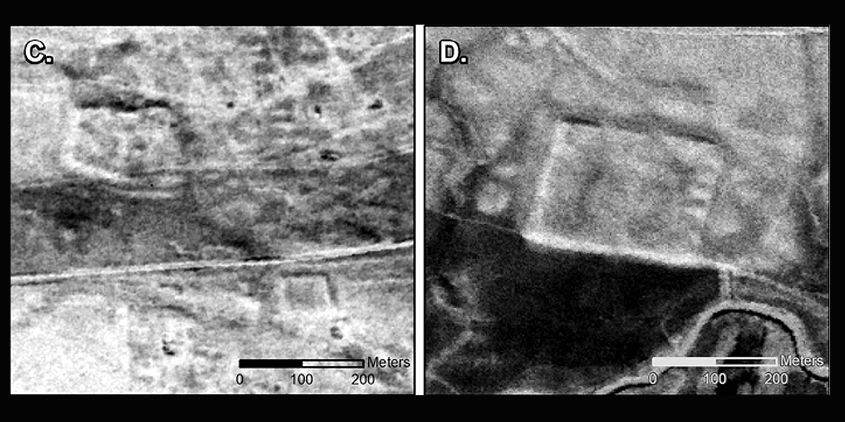
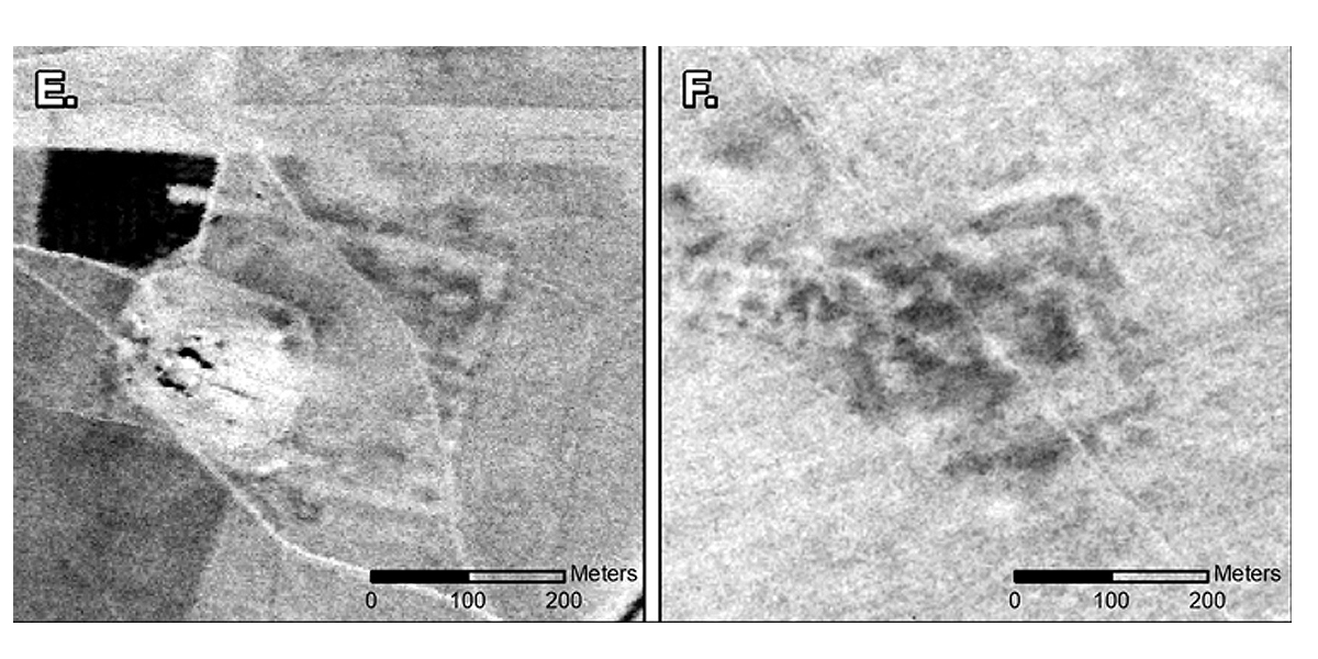
Archaeologists have used declassified spy satellite imagery from the 1960s and 70s to reevaluate one of the first aerial archaeology surveys ever, revealing 396 previously undiscovered Roman forts in what is now Syria and Iraq

The initial survey, published by Father Antoine Poidebard in 1934, recorded a line of 116 forts that corresponded to the eastern frontier of the Roman Empire.
As such, it was thought that the forts were a defensive line to protect the eastern provinces from Arab and Persian incursions.
"Since the 1930s, historians and archaeologists have debated the strategic or political purpose of this system of fortifications," says lead author of the research, Professor Jesse Casana from Dartmouth College, "but few scholars have questioned Poidebard's basic observation that there was a line of forts defining the eastern Roman frontier."
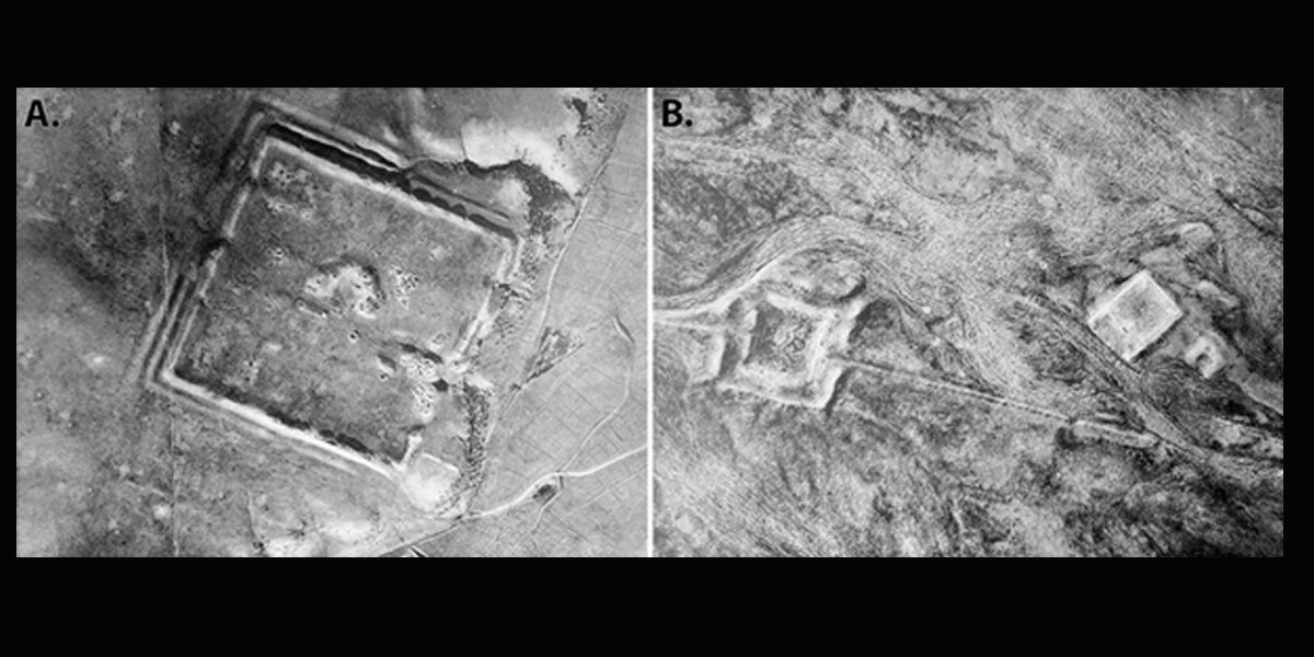
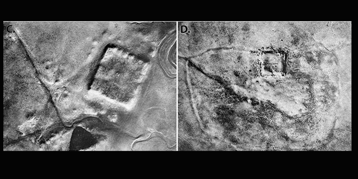
To tackle this, Professor Casana and a team of investigators from Dartmouth College utilized declassified spy satellite imagery from the Cold War to evaluate whether Poidebard's findings were accurate. Their results are published in the journal Antiquity.
"These images formed part of the world's first spy satellite programs," state the authors.
They "preserve a high-resolution, stereo perspective on a landscape that has been severely impacted by modern-day land-use changes."
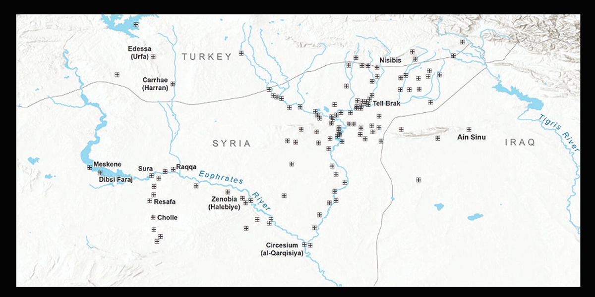
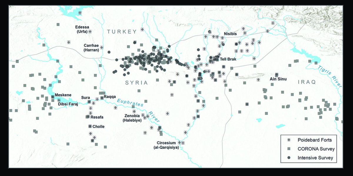
By using the forts found by Poidebard as a reference point, the team was able to identify 396 more. They were widely distributed across the region from east to west, which does not support the argument that the forts constituted a north-south border wall.
The researchers hypothesize that the forts were actually constructed to support interregional trade, protecting caravans traveling between the eastern provinces and non-Roman territories and facilitating communication between east and west.
Importantly, this indicates that the borders of the Roman world were less rigidly defined and exclusionist than previously believed. The eastern Roman frontier was likely not a place of constant violent conflict.
The Romans were a military society, but they clearly valued trade and communication with regions not under their direct control. As such, this discovery could have dramatic implications for our understanding of life on the Roman frontiers.
It also reveals the value of satellite imagery for recording archaeological features before they are lost.
"We were only able confidently to identify extant archaeological remains at 38 of Poidebard's 116 forts," states Professor Casana. "In addition, many of the likely Roman forts we have documented in this study have already been destroyed by recent urban or agricultural development, and countless others are under extreme threat."
This means that in fewer than 100 years since Poidebard's aerial survey, a very large number of Roman forts and other archaeological sites have been lost to urban development and intensified agriculture. This makes large-scale recording of archaeological landscapes especially vital to heritage preservation.
As more declassified imagery, such as U2 spy plane photographs, becomes available, new archaeological discoveries will be able to be made. According to Professor Casana, "Careful analysis of these powerful data holds enormous potential for future discoveries in the Near East and beyond."
More information: Jesse Casana et al, A wall or a road? A remote sensing-based investigation of fortifications on Rome's eastern frontier, Antiquity (2023). DOI: 10.15184/aqy.2023.153
Journal information: Antiquity
Provided by Antiquity
Subscribe to our newsletter
Stay updated on the latest technology, innovation product arrivals and exciting offers to your inbox.
Newsletter

