Share
Accessing carbon and nature payments from governments and other organizations often requires robust measurements to quantify restoration's positive impact, but these can be beyond the capacity of community organizations. New research, led by the University of Bristol, could provide an answer to this challenge.
Its findings show how small, inexpensive drones combined with free, open source software can be used by community forest organizations to calculate and monitor the amount of carbon stored in their forests.
The study results, published in PLOS One, demonstrate that carbon measurements gathered in this way are sufficiently accurate for establishing ongoing restoration monitoring, while being much simpler and cheaper than alternative methods, such as satellites and field-based surveys.
Lead author Dr. Ben Newport, Honorary Senior Research Associate at the University of Bristol's Cabot Institute for the Environment, said, "Our findings are exciting because they outline a clear and cost-effective workflow for upscaling accurate, transparent forest carbon monitoring from small field plots to tens of hectares—a scale that aligns well with community forests.
"This could potentially enable community forest groups around the world to engage with restoration funding schemes that would otherwise be beyond their technical capacities and, importantly, democratizes data collection and ownership."
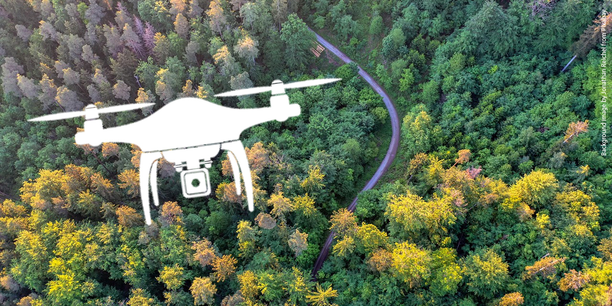
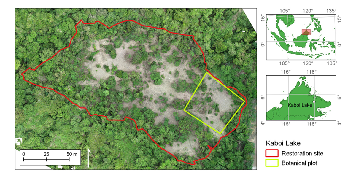
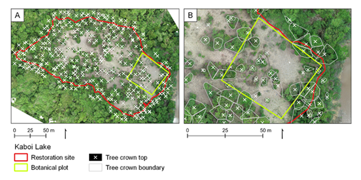
The international research team, including scientists from Cardiff University and the Danau Girang Field Centre in Malaysia, used a single lightweight, consumer-grade drone to take around 600 images of a community forest restoration site in Sabah, Malaysian Borneo, covering 2 hectares of selectively logged peat swamp forest.
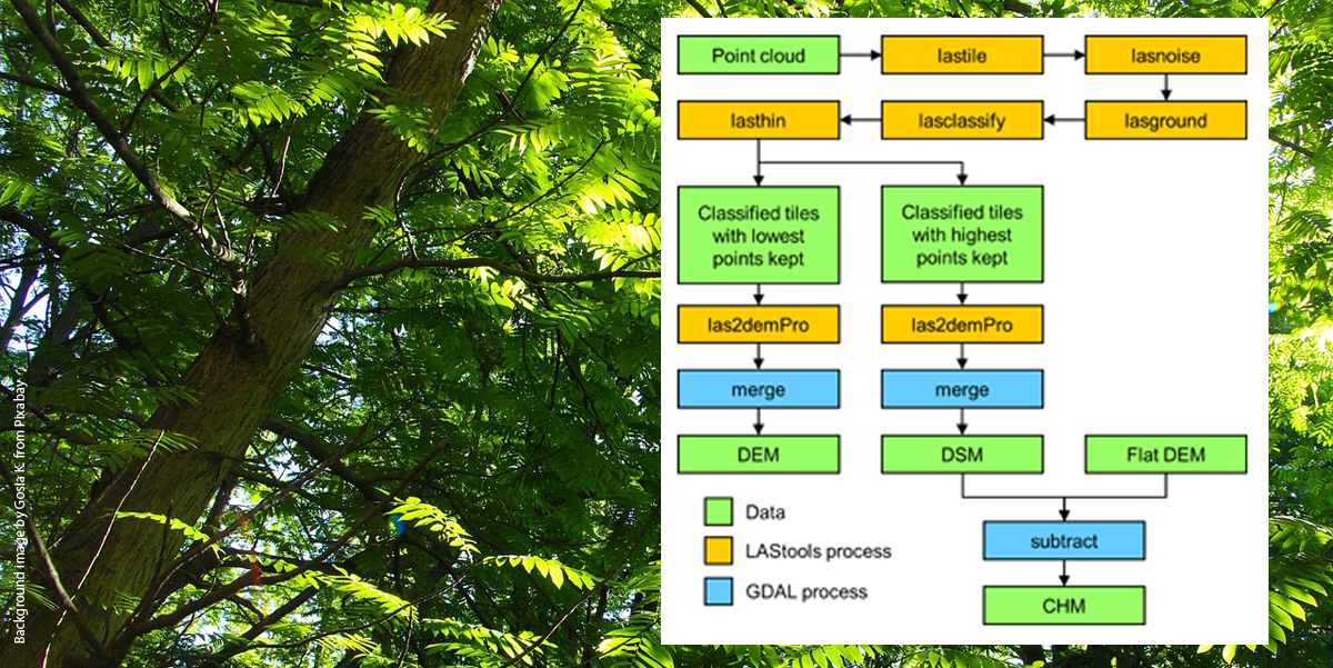
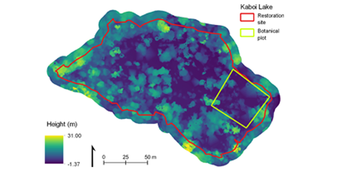
These images were processed using a technique called Structure-from-Motion photogrammetry, which produces 3D point clouds from sets of overlapping 2D images, allowing the forest canopy height to be calculated. From this the tree biomass was calculated using "allometric" equations and converted into the aboveground carbon currently stored within the restoration site.
The results showed that the drone-based carbon calculations were comparable in accuracy to those derived from field-based measurements.
Dr. Newport added, "Importantly, these measurements were produced using only a single drone and data collection took just one afternoon. However, care needs to be taken to select appropriate, regionally calibrated allometric equations to ensure the most accurate results."
There are tens of thousands of community-scale forest restoration projects globally and evidence suggests that these initiatives are more likely to endure than larger scale reforestation schemes.
"The drone we used can be bought for under £300 second-hand, making this a relatively accessible method for community groups who might have limited funds, especially when considering its repeatability," Dr. Newport explained.
"In addition to carbon measurements, communities across Borneo have also used these drones to document illegal mining occurring in their forests, support land tenure claims, and collect imagery to promote ecotourism businesses, so a drone can be an incredibly useful investment.
"But there are potential barriers to using a drone such as permit applications, training, and local opposition to drone flights that mustn't be overlooked, both for this method and other uses.
"In Borneo, local NGOs and research institutes can provide help and assistance in some cases, but there needs to be awareness that technology may not be so 'accessible' for different groups and in different locations."
Study co-author Professor Joanna House, Professor in Environmental Science and Policy at the University of Bristol, added, "The findings are very encouraging because restoring forests at a community level can significantly boost carbon storage and biodiversity gain, particularly when it empowers indigenous and rural communities through inclusion in forest monitoring and management. Experience has shown time and again that community involvement is critical to successful and ethical climate mitigation."
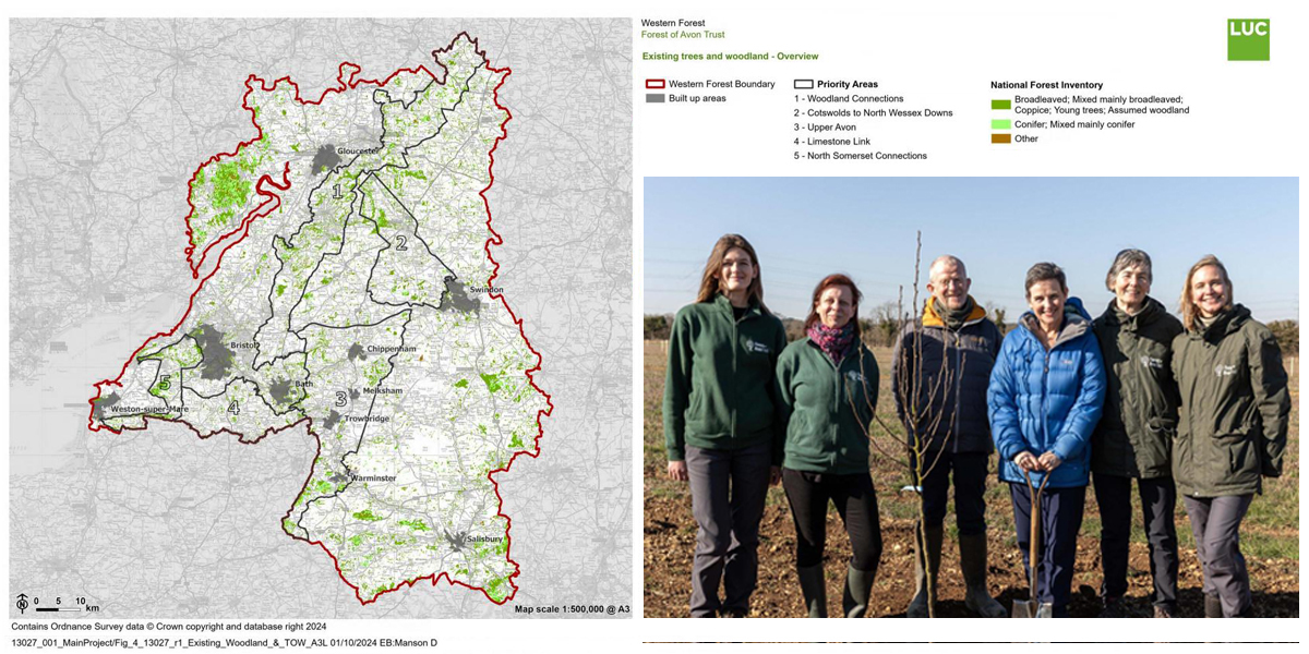
The research publication follows the recent Government announcement that three new national forests will be created to help meet a legally-binding target of achieving 16.5% woodland cover in England by 2050.
The first, called The Western Forest, will be made up of new and existing woodlands across Gloucestershire, Wiltshire, Somerset, the Cotswolds and the Mendips as well as in urban areas such as Bristol, Swindon and Gloucester. In addition to enhancing existing woodlands, 20 million trees will be planted to drive forward net zero goals, promote economic growth, and help slow the decline of wildlife species.
Dr. Newport, who is also a Land & Habitat Officer for the charity Avon Needs Trees and works to restore woodland and biodiversity across the Avon catchment, said, "It will be interesting to see how these methods can be adapted to involve landowners and stakeholders in the monitoring of forest restoration across the West of England.
"There is huge potential for the inclusion of citizen science in these projects. I'm also very excited to see how the methods outlined in our paper might allow communities in other locations, where funding is more limited, to also better monitor and protect their forests."
More information: Ben Newport et al, Simplifying drone-based aboveground carbon density measurements to support community forestry, PLOS One (2025). DOI: 10.1371/journal.pone.0322099
Journal information: PLoS ONE
Story Source: University of Bristol
Subscribe to our newsletter
Stay updated on the latest technology, innovation product arrivals and exciting offers to your inbox.
Newsletter

