Sam Wood of Navtech Radar argues that W-band radar, with its unrivalled level of resolution and all-weather resilience, will be increasingly important for situational awareness and targetless dynamic positioning in the booming offshore energy market

With the global offshore wind-energy market predicted to reach 240GW by 2030 (and double that by 2040), turbines and other infrastructure will become ever more commonplace on the horizon. With it comes new challenges, as the cost of deploying co-operative targets, or reference points, on every new turbine structure can be prohibitive.
It goes without saying that radar has been synonymous with the marine industry ever since its inception in the 1930s. But less well known is a relative newcomer to maritime settings, W-band, with its much higher resolution and reliability at near-distance ranges and, where conventionally, Lidar in combination with cameras and GNSS have been deployed.
To aid situational awareness and dynamic positioning, W-band is becoming increasingly crucial to the many applications we see in the marine sector today from, as highlighted, offshore environments that are increasingly concentrated with man-made structures, to near shore and inland waterways where the cost of collisions and congestion can be of colossal proportions, as we saw with the Evergreen that lodged itself in the Suez Canal two years ago.
The necessity for dynamic positioning
Dynamic positioning (DP) - the process of stabilising a vessel’s position in relation to its changing environment - originated in the 1960s and developed with the advent of offshore drilling. As these operations moved into ever deeper waters, conventional methods such as Jack-up barges became inadequate, while anchoring in deep waters proved to be uneconomical.
Over time, DP technology underwent significant advancements. From its initial development with analogue controllers and limited redundancy, it has evolved into a highly sophisticated system with superior capabilities and is no longer restricted simply to maintaining a fixed position. Modern DP systems offer the versatility of sailing an exact track, making them invaluable for tasks such as cable and pipe-laying, surveying, and myriad other tasks that are required to maintain and service a growing global suite of windfarms.
A modern DP-equipped vessel is reliant on its position reference sensors to enable the advanced functionality afforded by advanced computer control and can be broadly categorised as two type of system: global references, and local references. Global references are systems such as GNSS that rely on a set of globally-visible satellites or other known global references to provide a position. Local reference systems provide a range and bearing to a local cooperative target. Such systems typically employ laser or Lidar position reference sensors.
Most of these platforms – oil and gas installations in the main - are equipped with laser targets that allow supply vessels to line-up with an appropriate spot on the platform and then maintain that position using DP technology. An ideal operation also allows the vessel to approach the platform using multiple local reference sensors, improving safety, thorough redundancy, and speed of operation.
In the growing seascape of wind farms, however, there is a paucity of targets, which has meant new methods and systems being deployed to counter the requirement to fit every wind turbine with a target, each with its own power supply, electronics and inherent vulnerabilities, not least cost. The first on the scene was Lidar, which measures the time difference between light travelling to and from the target or structure. Lidar has proved a highly accurate aid to DP and navigation, but it’s not without its disadvantages, which is why W-band radar is required for redundancy.
Why W-band?
As we explain in our recent publication ‘Marine Report: Charting a Course for Marine Automation and the Role of Radar’, most GNSS systems cannot provide positional accuracy to less than 10 metres when they are close to large objects. This is due to signal blocking and multipath errors, the latter occurring when satellite navigation signals are reflected off nearby structures such as platforms, other ships and, now, wind turbines.
With its higher frequency, LiDAR has a part to play. Even so, its limited detection range and, perhaps more importantly, severe limitations in adverse weather conditions, means that the LiDAR sensors require constant attention, with its own risks and dangers.
Radar, however, is more robust. Most marine radar systems on ships operate on S-band and X-band respectively. Operating at 3 GHz, S-Band has a range of 74kms or 40 nautical miles. However, it is W-band radar (76-77Hz) that can deliver the most spectacular imagery and accuracy, with a 500m range, as well as being independent of GNSS and infrastructure and highly resilient to rain, fog and glare.
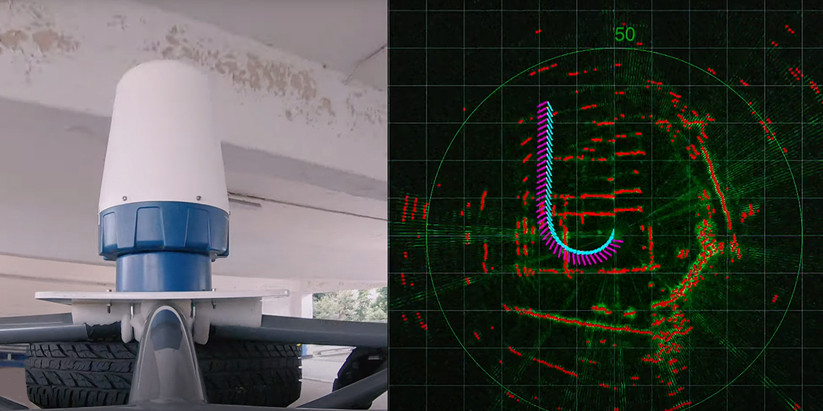
Comprising a single 360° radar sensor and a small, low-power processing unit, the picture it can acquire from of its local environment can be used to output accurate odometry, from which it can build a local map of the vicinity. By using this map, it can locate the position of the sensor within it. ‘Driverless’ cars use similar systems to build a picture of their surroundings.
Utilising a single high-resolution sensor, the system uses radar images alone to provide accurate motion estimation in three degrees of freedom, x, y, angle. Radar motion estimation can used in tandem with a radar map of the area to provide absolute positioning. The system outputs NMEA style messages that can then be used by downstream systems. The system uses an innovative keypoint-based framework that ensures centimetre-level accuracy, resilience, and reliability across diverse conditions.
In this way, the radar data can be integrated with data from other sensors such as GPS, GNSS, inertial data, laser, camera and sonar.

Future opportunity
In the face of climate change and the urgent drive for green energy, the offshore renewable market is set to grow rapidly over the next decade onwards, including technological innovation in floating windfarms and other infrastructure. This, in turn, will see a proliferation of man-made structures in our seas. Consequently, the importance of safe navigation through these more congested seaways cannot be understated. Equally, smarter solutions need to be deployed that require minimal setup and cost, both requirements that W-band radar immediately fulfils by enabling targetless positioning.
Developed in the UK, Navtech Radar’s Terran360 solution can enable the autonomous navigation of boats in environments where GNSS cannot operate; it can deliver accurate positioning in all weather conditions, day or night; improves vessel productivity, and is operable around-the-clock with no worries about unreliable GNSS positioning or sensor failures. What’s more, when vessels take the most efficient routes they produce fewer emissions – so Terran360 can also help operators to achieve their sustainability goals.
Current forecasts indicate that remotely-controlled craft will become ubiquitous well within this decade, to be closely followed by unmanned ocean-going vessels, all of which are set to transform maritime and many other industries that depend upon it, from renewable energy to the world’s supply chain.
As sensory systems, from millimetre wave radar to satellite enabled propulsion controls become ever more commonplace in maritime automation, the fusion of multiple sensors will become the default, of which near-distance W-band radar will be core.
For more information about Navtech Radar, visit www.navtechradar.com, or download the free ‘Marine Report: Charting a Course for Marine Automation and the Role of Radar’.
Sam Wood is Product Manager for Autonomous Solutions at Navtech Radar, based in Wantage, Oxfordshire, UK (https://navtechradar.com )
Subscribe to our newsletter
Stay updated on the latest technology, innovation product arrivals and exciting offers to your inbox.
Newsletter

