Share
It doesn't matter whether you're mapping land, inspecting infrastructure, planting crops, or flying drones—GNSS is the utility you don’t see, but can’t work without, writes Emlid’s CEO and co-founder Igor Vereninov.
When you think of GNSS (Global Navigation Satellite System), maps and smartphone navigation come to mind. But GNSS is no longer just that. It’s a silent backbone of modern infrastructure: a global utility powering industries from agriculture to emergency response with precise geopositioning. Like electricity or the internet, GNSS quietly underpins critical operations every day.
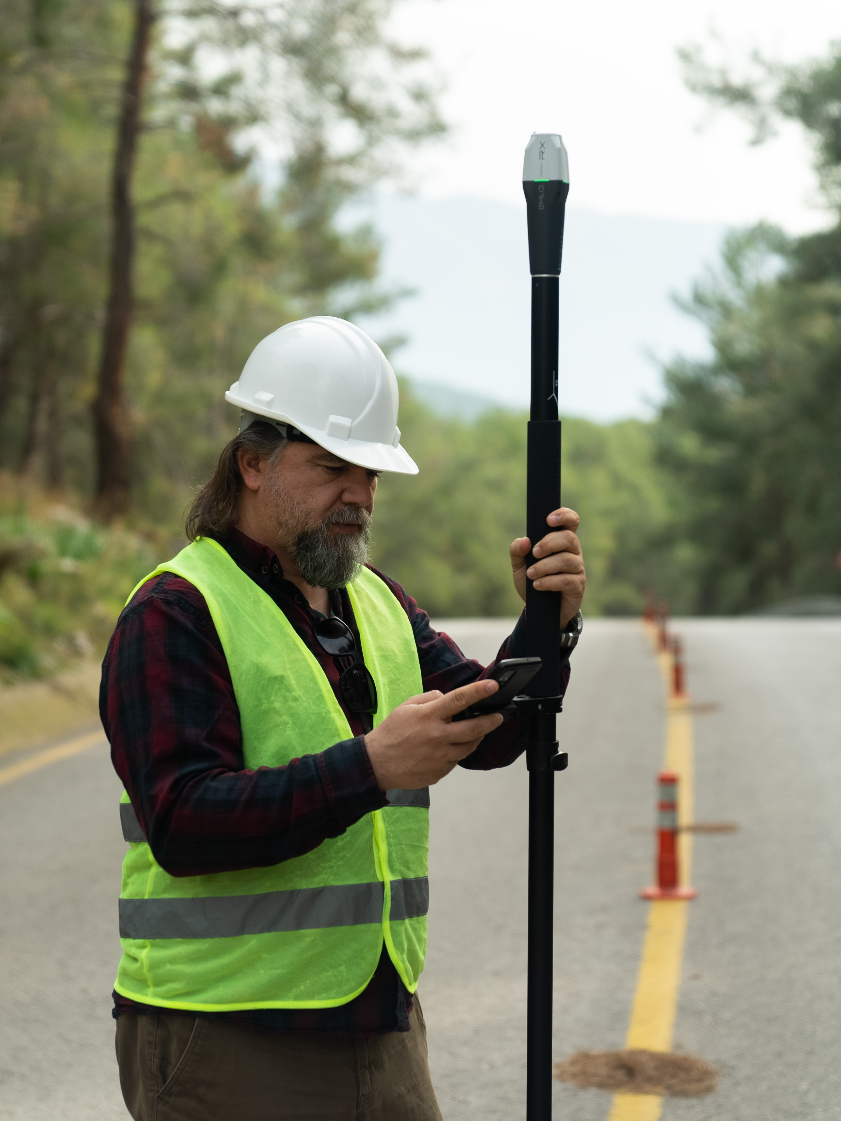
Behind this transformation is a wave of innovation that made centimeter-level positioning not just possible, but accessible. Emlid is one of the companies leading the change, designing GNSS receivers that bring centimeter accuracy to anyone who needs it: surveyors, drone pilots, GIS specialists, farmers, students, and more. This approach combines smart design with advanced tech, changing the way people use precision data around the world.

How GNSS transformed industries across the globe
A decade ago, high-precision GNSS was accessible only to well-funded engineering teams. The receivers were bulky, costly, and required extensive technical expertise to operate. Meanwhile, industries like drone mapping, autonomous navigation, and precision agriculture were rapidly evolving. They needed accurate positioning solutions that were simpler, more affordable, and easier to deploy.
At the same time, advances in open-source software and affordable chipsets created a timely shift in GNSS technology. Emlid was one of the companies that saw this opportunity and brought those components together in usable, compact, and survey-grade GNSS receivers named Reach.
As GNSS receivers became more accessible, the technology has gone from niche to essential. Today, numerous sectors depend on GNSS for accurate spatial data. It's embedded in workflows for drone mapping, environmental monitoring, forestry, land management, infrastructure, and beyond.
In fields where even small location errors can have significant consequences, centimeter-level positioning is now within reach, scalable across teams, and adaptable to projects of any size.
Real-world GNSS impact
Efficient environmental assessment in the USA
Ryan Gay, GIS and remote sensing project manager at Whitenton Group, supports oil and gas infrastructure projects through rigorous preconstruction assessments. His team conducts wetland delineation, stream mapping, and special-status plant surveys to ensure compliance with the US laws and environmental regulations. To meet the US Army Corps of Engineers’ requirement for mapping accuracy, Ryan’s team uses the Emlid Reach RX receivers in combination with Esri ArcGIS apps.
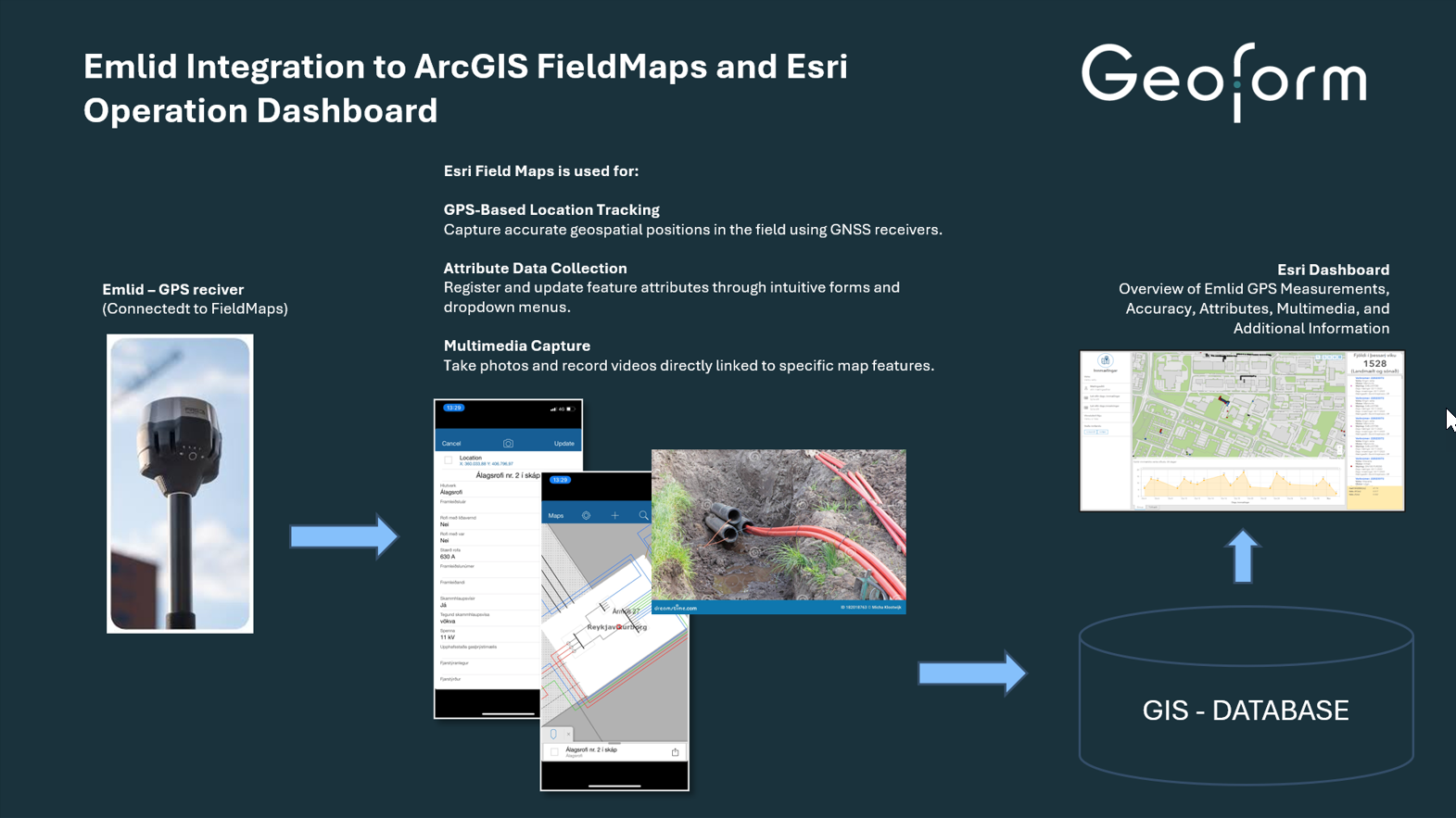
With Reach RX and ArcGIS Field Maps, the team maps environmentally sensitive areas in the field. The collected data is then reviewed and finalized in ArcGIS Pro. This ensures reliable spatial documentation for permitting. In parallel, the team performs adaptive special-status plant surveys, where findings update live on shared maps, speeding up collaboration and compliance reporting.
To supplement their ground surveys, the team uses LiDAR-enabled drones to model terrain in dense vegetation. With the Reach RS2+ base station logging GNSS correction data and the PPK (post-processing) workflow, they achieve up to 3 cm data accuracy. Ryan reports that switching to Emlid’s system and synced workflows has significantly reduced time spent on data processing, rework, and manual coordination across teams.
Rebuilding infrastructure mapping in Iceland
Another Emlid user, Valdimar Kjartansson, led mapping operations for one of Iceland’s largest utility companies. Under his guidance, the company transitioned from conventional workflows to a streamlined, real-time data collection powered by 40 Emlid Reach RS3 units. Each field crew vehicle was equipped with a receiver, enabling direct data collection, photo capture, and registration via Esri ArcGIS Field Maps.
It wasn’t just faster. It ensured better control over data accuracy and less dependence on third-party contractors. Real-time dashboards displayed live field data, improving communication between surveyors and the design teams.
After eight years of driving this transformation, Valdimar founded his own company. Today, he works with municipalities and utility providers across Iceland using the same tools—Reach receivers and Esri software. His services range from measuring underground cables and mapping streetlight poles to building complete GIS-based infrastructure inventories.
How dependent are we on GNSS today?
We don’t often think about what makes our world work. However, GNSS is so deeply embedded in daily life. To fully grasp the true impact of GNSS, consider what happens when it stops functioning. I like the term global utility because that’s what GNSS has become. It’s incredibly useful for so many things worldwide.
One striking example came in April 2023, when farmers in New South Wales and Victoria, Australia, found their machinery inoperable due to a GNSS signal outage. Tractors equipped with high-precision GPS suddenly lost guidance, forcing some operators to fall back on manual methods or just stop farming.
This is just one case illustrating how something in space can go wrong, and suddenly, the usual things on Earth can’t operate, or even we can’t grow food.
GNSS is evolving, but will smartphones catch up?
As GNSS technology becomes more accessible, a common question in the tech world arises: Can smartphones fully adopt this technology and replace professional GNSS receivers? The short answer: not anytime soon.
The difference lies in the hardware. High-precision GNSS receivers are built with specialized chips to receive multiple signals across various frequencies from each satellite. But the chip is just one part of the equation. These systems also include a powerful antenna to capture clean signals, a receiver to convert them into raw data, and a processor to calculate highly accurate positions.
Smartphones, despite constant software improvements, face notable hardware limitations. Their antennas are too small for precise signal capture, and most can only process a single signal per satellite. They also struggle to handle correction data effectively, which is critical for centimeter-level accuracy.
To match the performance of GNSS receivers, smartphones would require a complete hardware overhaul, trading portability for precision. In the meantime, this is something unlikely in mainstream consumer design. So while your phone can get you to the nearest coffee shop, it’s no substitute for mapping a farm or guiding a drone through a field. For that level of precision, GNSS receivers are here to stay.
The future of GNSS: working alongside visual positioning
Another growing point of debate in the tech world is whether GNSS can compete with the rise of visual positioning, or whether it even needs to.
Visual positioning uses a camera to identify an object’s location by comparing its surroundings with a stored 3D map. It performs well in urban environments, where buildings and landmarks provide rich visual references. In contrast, GNSS signals in such settings can suffer from multipath errors or signal dropouts due to reflections off buildings.
But in rural or remote areas, like cornfields, deserts, or forests, visual cues are often sparse, repetitive, or absent altogether. In these wide-open landscapes, GNSS remains the most reliable tool for positioning.
Rather than replacing satellite-based positioning, visual systems are likely to work alongside GNSS, improving coverage and redundancy. For global, reliable, and centimeter-level accuracy, GNSS is the way to go.
Precision from space, in your hands
It’s still amazing to think that thousands of kilometers above us, satellites constantly broadcast signals that help us locate ourselves to within a centimeter. And with modern GNSS equipment, that data is now in the hands of everyday professionals, not just professional surveyors.
Igor Vereninov is the co-founder and CEO of Emlid
Subscribe to our newsletter
Stay updated on the latest technology, innovation product arrivals and exciting offers to your inbox.
Newsletter

