Share
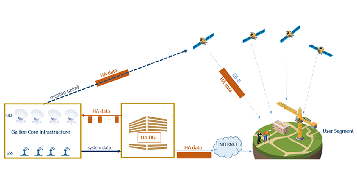
A group of Canadian scientists is the first to make use of Galileo’s High Accuracy Service (HAS) to create ultra-precise 3D maps of underwater terrain in a place that has no RTK networks or Internet
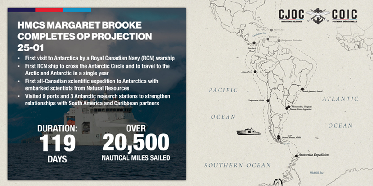
The first all-Canadian Antarctic research expedition mounted by the University of New Brunswick has successfully surveyed both coastal and oceanic sites and mapped seafloor in Antarctica using Europe’s Galileo High Accuracy Service (HAS) and the Eos Positioning Systems® Arrow Gold+™ GNSS receiver.
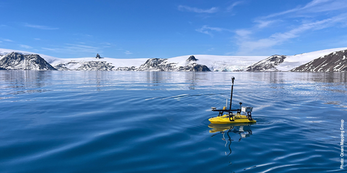
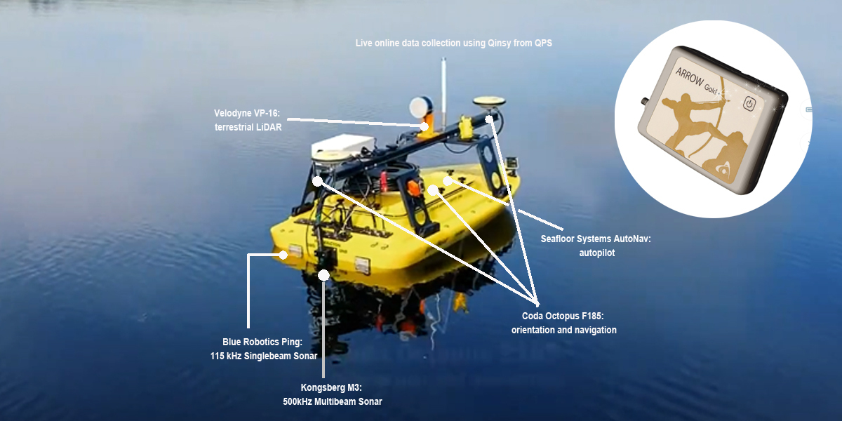
During a month-long Canadian Department of National Defence Operation PROJECTION mission aboard the HMCS Margaret Brooke, a small Unmanned Surface Vessel (USV) was deployed by the University’s Ocean Mapping Group across the icy waters of the South Shetland Islands. With no Real-Time Kinematic (RTK) infrastructure or Internet to rely on, the team turned to Galileo HAS (the EU free satellite-based PPP correction service) and the Arrow Gold+ to guide the USV with pinpoint accuracy.
The result? High-resolution, 3D maps of underwater surfaces
The GNSS receiver delivered real-time (no post processing) positions with estimated accuracies of about 10 centimetres horizontal and 15–20 centimetres vertical, both accuracies with 1 sigma RMS (68%) and achieved solely through GNSS. This key innovation for bathymetric surveys in remote terrain allowed high-resolution, 3D maps of underwater features like the volcanic caldera of Deception Island.
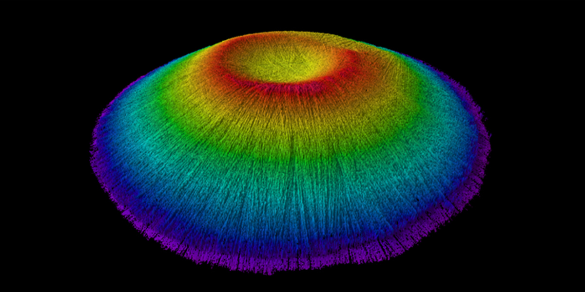
By adding high-accuracy locations with an average accuracy of 10-20 centimetres horizontal and vertical, the team was able to accurately georeference and further refine the detail of the bathymetry for their map inside the underwater Deception Island caldera.
When asked about any potential challenges they faced, Ocean Mapping Group research scientist Kevin Wilcox, who piloted the USV, commented “The convergence time typically ranged from 30-40 minutes. While it wasn’t as consistent as what you might get elsewhere, 10 to 20 centimetres was quite good all things considered. After all, you are at the bottom of the Earth!”.
About Galileo
Galileo, the EU´s Global Navigation Satellite System (GNSS), provides improved navigation, positioning and timing information. More than 4 billion users are already benefitting from Galileo.
The Galileo Programme is owned by the EU. The European Commission, as the Programme Manager, oversees the implementation of all activities. EUSPA is responsible for the operational management of the services, ensuring that they are delivered with the defined performance and without interruption. Galileo's system design and system evolution are entrusted by EUSPA to ESA.
Story Source: European Union Agency for the Space Programme (EUSPA)
Subscribe to our newsletter
Stay updated on the latest technology, innovation product arrivals and exciting offers to your inbox.
Newsletter

