Share
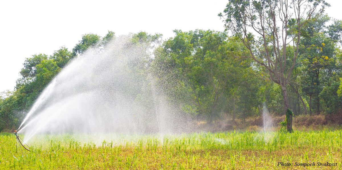
Sustainable water management is an increasing concern in arid regions around the world, and scientists and regulators are turning to remote sensing tools like OpenET to help track and manage water resources.
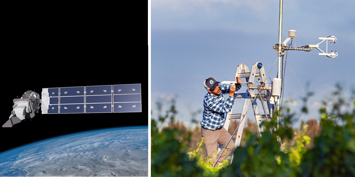
OpenET uses publicly available data produced by NASA and USGS Landsat and other satellite systems to calculate evapotranspiration (ET), or the amount of water lost to the atmosphere through soil evaporation and plant transpiration, at the level of individual fields.
This tool has the potential to revolutionize water management, allowing for field-scale operational monitoring of water use, and a new study provides a thorough analysis of the accuracy of OpenET data for various crops and natural land cover types.
In the study, published in Nature Water, Desert Research Institute (DRI) scientists led a large team of researchers in a comparison of OpenET data to evapotranspiration data produced by 152 ground-based micrometeorological stations known as eddy covariance flux towers.
The researchers found that OpenET data has high accuracy for assessing evapotranspiration in agricultural settings, particularly for annual crops like wheat, corn, soy, and rice. OpenET results for these crops were particularly reliable in arid regions like California and the Southwest, supporting the use of this tool to address an ongoing regional water sustainability crisis.
"One of the biggest questions for users of OpenET data is how accurate it is, given the magnitude and implications of the use of the data for water resource management," said John Volk, Ph.D., lead author of the study and assistant research scientist and software engineer at DRI. "A lot of groups want to know what the expected rates of error are in agricultural lands, so that's the major question that we wanted to address for this paper."
The eddy covariance stations consist of instruments and techniques for calculating the flux of trace gases, like water vapor, coming off the land surface. They offer one of the best methods for quantifying evapotranspiration on the ground, Volk says, which provided the researchers the opportunity to compare the ground-based observations with those provided by satellites.
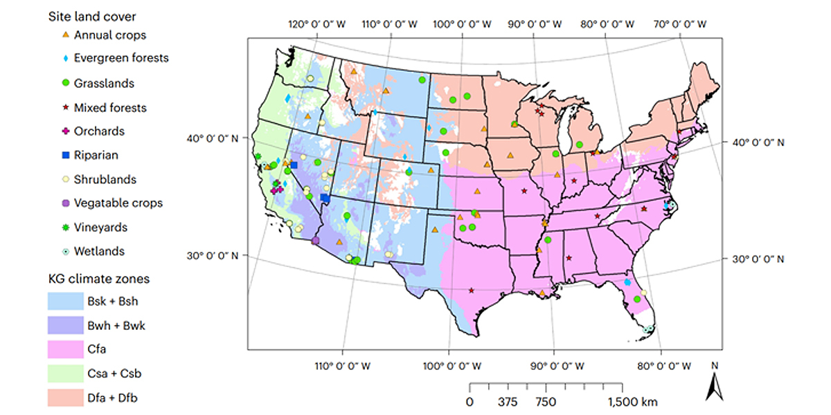
Each station's data was compared to the OpenET model ensemble, which combines six different Landsat-based models to produce an average, as well as data from each individual model. Then, the stations were grouped by land cover type and climate zone to assess how the accuracy of OpenET data changes across these variables.
"I was impressed by the level of performance of the OpenET system," Volk said. "It's kind of surprising how well the models did, and how well they agreed with one another in agricultural sites—particularly in the peak growing season when water demands are the highest."
For annual crops, OpenET data for monthly, growing season, and annual evapotranspiration had an average error rate of approximately 10–20%, which is within the targeted range set by OpenET partners such as farmers and water management agencies. For annual crops growing in Mediterranean climates, monthly error rates were consistently below 10% during peak growing season, emphasizing the usefulness of this data. Accuracy for orchards was more variable (17%), which could be related to the way that shadows impact satellite data for taller vegetation, the authors say.
OpenET data can also be used for monitoring evapotranspiration in natural ecosystems and error rates for most natural land cover types was less than 1 mm per day at monthly to annual timesteps. However, ET rates are generally lower for these ecosystems, resulting in relative error rates that are higher in these environments than in croplands, and range from 35% for forests to 50% for shrublands. While the relative errors are higher for natural ecosystems, the ET data are still useful as indicators of drought impacts, vegetation water stress and water availability.
"Evapotranspiration is one of the hardest hydrologic fluxes to measure, and to think we are quantifying this flux from space with comparable or better accuracy to ground-based weather stations and meter data for agricultural lands is really remarkable," said study co-author Justin Huntington, Ph.D., research professor at DRI.
"The combined use of the Landsat-satellite archive with new Google Earth Engine cloud computing resources has been key, as has our collaboration across different research groups and use of multiple models to better understand model strengths and weaknesses and identify areas for improvement."
Future research will focus on natural ecosystems and how OpenET models compare under different agricultural demand management and conservation actions, such as those being explored in the Colorado River Basin.
The study notes that although all OpenET models have room for improvement, the results show the remarkable progress achieved in developing fully automated remote sensing techniques for mapping evapotranspiration at large spatial scales and at the resolution of individual fields based on petabytes of Landsat satellite data and new cloud computing resources.
"Farmers and water managers increasingly need accurate, field-level data on water use," said Maurice Hall, OpenET director and senior advisor, Climate Resilient Water Systems, Environmental Defense Fund. "This study helps confirm the vital role OpenET plays in providing a more granular, dynamic picture of water use that can meaningfully inform real-time water decision-making. We look forward to continuing to refine and expand the implementation of OpenET to ensure farmers, ranchers, and communities can thrive in a world of highly stressed and variable water supplies."
More information: John M. Volk et al, Assessing the accuracy of OpenET satellite-based evapotranspiration data to support water resource and land management applications, Nature Water (2024). DOI: 10.1038/s44221-023-00181-7
Story Source: Desert Research Institute
Subscribe to our newsletter
Stay updated on the latest technology, innovation product arrivals and exciting offers to your inbox.
Newsletter

