Share
Our latest case study by Thomas Gaisecker, RIEGL Manager Mining Business Division, covers how the RIEGL VZ-2000i is helping the local government of Tyrol, Austria, ensure the safety of residents and tourists.
Austria is a small country with a rather high proportion of densely populated space in the alpine terrain. Even within the smallest valleys and at the steepest slopes; settlements and infrastructure, such as roads and railways are present. These settlements have existed for centuries and have been laid out in accordance with the experiences of their inhabitants at the safest possible points. Today, they are protected by structural measures from corresponding dangers, such as rockfall, mudflows and avalanches. In the case of linear infrastructure, not every detail part can be fully protected. Fig. 1 shows a typical mountain landslide as it often occurs after winter. When snow is melting away, temperatures rise, and the soil is not frozen anymore. The high-water content on the ground may cause the slope, that is not sufficiently solidified, to slip. During summer, strong thunderstorms cause the slope stability to decrease due to the high amount of water within the soil. The shown street on Fig. 1 is the only connection to a village at the end of the valley. As the region depends on skiing tourism during winter, it is crucial to repair the street and ensure safety before the first snow in Autumn.
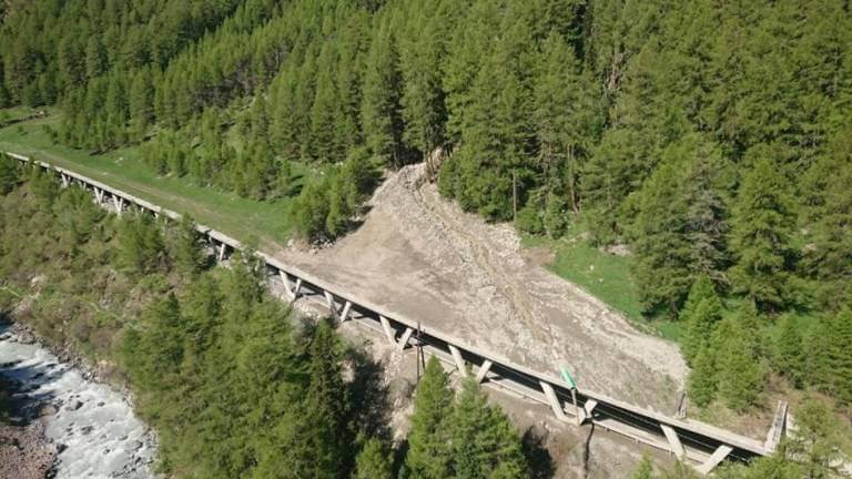
Fig. 1: Road gallery damaged by landslide
The local government of Tyrol (a province of Austria), has decided to establish permanent geo-monitoring to ensure the safety of road construction staff and also the safety of the public after re-opening the road. A RIEGL VZ-2000i 3D terrestrial laser scanner is now permanently positioned on the opposite side of the valley and will be used for data-acquisition. It is mounted on a concrete pillar to guarantee a stable position. Uniquely constructed small, wooden housing, protects the scanner and the electrical equipment from weather impact (Fig. 2). The monitoring project’s area of interest is highlighted in red on Fig. 2. The maximum range from the scanner’s position to the area of interest is almost 1500m (Fig. 3). The maximum range of the RIEGL VZ-2000i is 2500m, this guarantees enough range capability even in poor weather situations, such as rain and fog. The scanner is working 24/7 and acquires data every two hours through one high resolution scan with a point gapping of approx. 20cm in 1500m range.
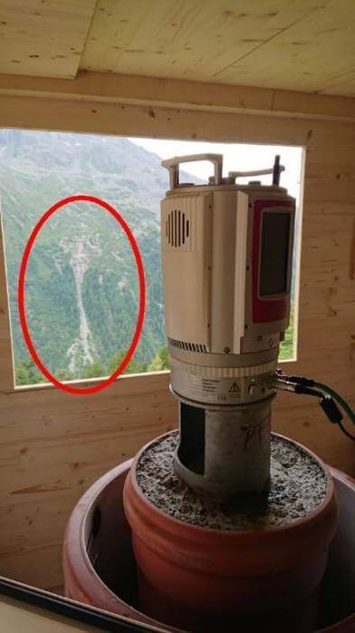
Fig. 2 RIEGL VZ-2000i inside the housing, area of interest highlighted in red
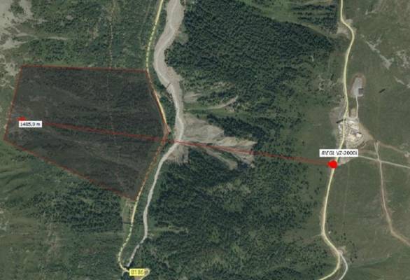
Fig, 3 Position of RIEGL VZ-2000i and distance to area of interest
Data acquisition, scheduling and processing of the data is performed online on the scanner by using RIEGL’s brand-new Monitoring App (Fig. 4). Raw data is processed and a 2D image of the data is generated. For every pixel of this image, a surface normal vector is calculated by analyzing the local neighborhood. The Web-Viewer, part of the Monitoring App, allows for a comparison along the surface normal vector between one scan and a reference scan (Fig. 5). One can immediately identify the areas of change, further indicating movements on the surface. For a detailed analysis, single pixel values can be highlighted.
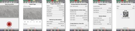
Fig. 4 Monitoring App, screenshots of GUI (Graphical User Interface) on the scanner
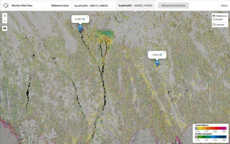
Fig. 5 WebViewer of Monitoring App
Scan raw data and the processed results (Web-Viewer images) are synchronized automatically via LTE mobile network onto a NAS (Network Attached Storage) within the computer network of the Tyrolian government. A Web Server publishes the Web-Viewer data on the intranet of the Tyrolean government. Via a Citrix Server, users from outside of this network can login with a username and password to access the Web-Viewer data. If the specialist recognizes critical changes, scan data from the NAS can be downloaded for a detailed analysis within RiSCAN PRO. For users from outside of the network, the IT department of the government installed an FTP-Server to download data from the NAS-drive. The RIEGL team has direct access to the scanner, as well as the Citrix Server for administration and troubleshooting if needed. A detailed diagram of the network configuration is shown in Fig. 6.
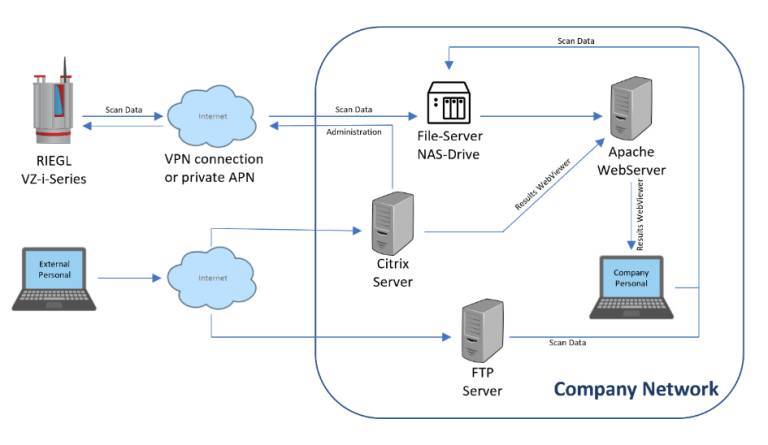
Fig 6 Network configuration
Due to its long measurement range, highly accurate and informative measurement data, along with the advantages of the new Monitoring App, the RIEGL VZ-2000i is able to provide up-to-date and reliable information. This enables the specialists in the Tyrolean local government to monitor and evaluate the risk potential for this single connection. Ultimately, this will help to ensure that the appropriate decisions regarding safety are made in time, guaranteeing safety for residents and tourists in this hotspot.
Subscribe to our newsletter
Stay updated on the latest technology, innovation product arrivals and exciting offers to your inbox.
Newsletter

