Share
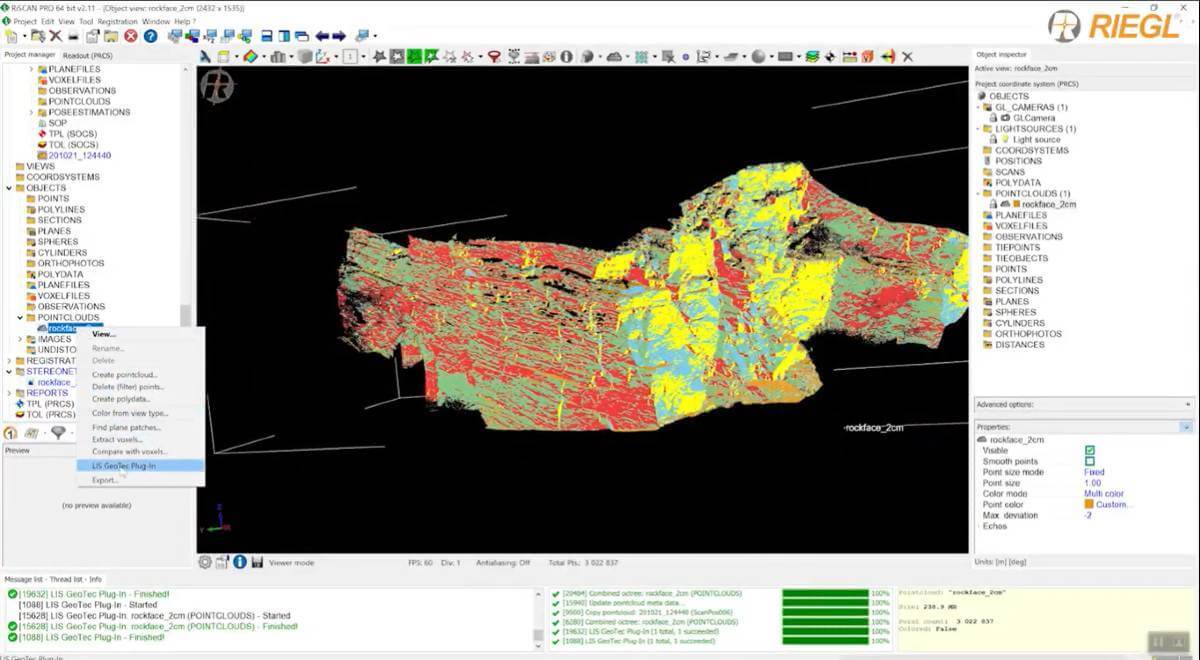
With the LIS GeoTec software tool, RIEGL provides a RiSCAN PRO Plugin for geotechnical analysis of scanned rockfaces.
It facilitates the calculation of surface normals for a local neighborhood. These surface normals are further analyzed to detect clusters of pre-dominant surface orientations, which are used for data classification and visualization on a polarplot diagram.
More details can be found in the LIS GeoTec Plugin Infosheet.
Watch the video and get an insight on how RIEGL 3D Terrestrial Laser Scanners, RIEGL‘s proven software RiSCAN PRO and the LIS GeoTec Plugin support the geologist’s work and provide the relevant analysis data contact-free, fast, and without exposing staff to danger as climbing in the rock wall is no longer necessary.
Subscribe to our newsletter
Stay updated on the latest technology, innovation product arrivals and exciting offers to your inbox.
Newsletter

