Share
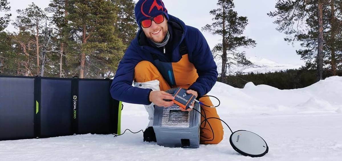
Septentrio, a provider of high-precision GNSS positioning solutions, is supporting climate research in conjunction with the Royal Observatory of Belgium by equipping two Belgian adventurers with the latest GPS/GNSS technology for collection of accurate positioning data.
This data will help build a precise elevation profile of the Greenland Ice Sheet as well as to calibrate existing elevation models, which are based on satellite altimetry. In addition, the multi-frequency capability of the AsteRx-SB receiver will enable monitoring of the ionospheric activity as well as Galileo signals at high latitudes.
“The AsteRx-SB receiver provides accurate and reliable positioning data even in the world’s harshest environments. Data collected during this first-of-a-kind expedition will help research of arctic ice caps, ionospheric activity and other topics,” said Dr Nicolas Bergeot, Time-Ionosphere section of the Royal Observatory of Belgium.
The expedition is called Nanok, which is an Inuit word for polar bear. The adventurers, Gilles Denis and Nathan Goffart, started the triathlon with a 600 km of ski with a pulk sled along the Arctic Circle. The second part of the triathlon is a 1000 km sea kayak along the Greenland east coast, and finally there is a 1 km vertical rock climb for the opening of a new route. The AsteRx-SB receiver and the PolaNt-x MF antenna is accompanying the explorers for the whole journey. For more information about Septentrio receivers contact the Septentrio team.
Subscribe to our newsletter
Stay updated on the latest technology, innovation product arrivals and exciting offers to your inbox.
Newsletter

