Share
Phase One, a developer of digital imaging technologies, announced its next-generation aerial mapping solutions.
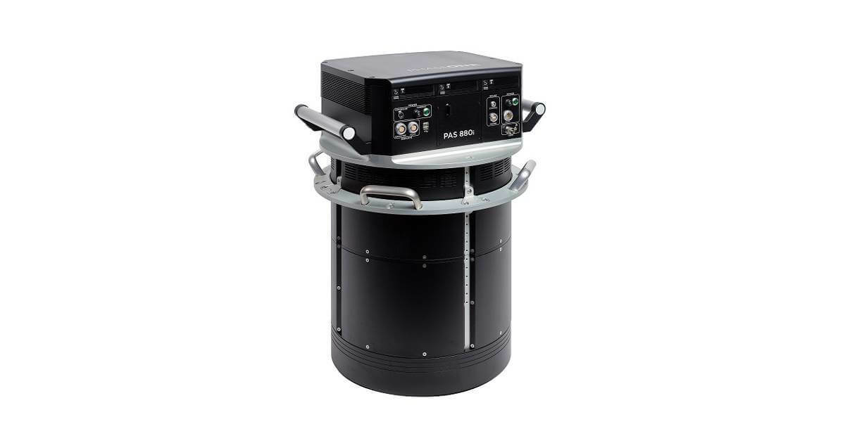
The Phase One PAS 880 oblique and PAS 280 nadir systems have been enhanced with 150MP near-infrared (NIR) sensors and the most productive workflow with the launch of the latest iX Suite SW solution. The new PAS 880i and PAS 280i will be unveiled at the 2022 GEO Business Conference in London May 18-19th 2022.
The new PAS 880i offers the same outstanding image quality and unsurpassed image capture rate (2 frames/second) that gained its forerunner a reputation for reliability and productivity. The PAS 880i covers a wide swath across-track: more than 20,000 pixels in nadir and 14,000 pixels in each of the obliques, operated at a variety of airspeeds, altitudes, and lighting conditions. It is the only solution in the market that can capture the highest resolution, blur-free images under the same flying altitude and speed conditions for nadir and oblique simultaneously.
“Already the most productive large-format aerial solution, the PAS 880i is now also the most versatile,” said Anthony Garetto, VP, Phase One Geospatial. “Users have the option of operating the PAS 880i in full nadir/oblique mode for wide-area mapping and 3D city modeling projects, or nadir-only mode for photogrammetric applications. The enhanced PAS 880i now includes a 150MP near-infrared sensor with 50mm lens, adding simultaneous data capture of the near-infrared band for a complete 4-band solution.”
Image sensors are one of the fastest developing technologies. Modern Bayer sensors are incredibly efficient and demosaicing algorithms have made huge progress over the last decade.
Phase One has been the leading developer of high-end Bayer processing algorithms and software for almost 30 years and has made it a business priority to keep pushing the limit of Bayer processing quality.
“In aerial mapping, Pan Sharpening is a complicated and cumbersome approach where multiple cameras must be pointed at the same areas on the ground to collect both luminance and color information. With the Bayer pattern sensors that we use at Phase One, this is not necessary resulting in much simpler and more compact systems for the same coverage. Bayer pattern technology provides a much better GSD/Coverage for any given pod size,” said Lau Nørgaard, CTO at Phase One.
With over 20,000 RGB pixels across flight direction, the PAS 280i is an effective large format aerial solution of 280MP combined with a 150MP NIR camera. This ensures a higher return on investment than other large-format systems. PAS 880i is based on the PAS 280i solution, enabling a seamless upgrade to a full oblique system, ensuring a future-proof and effective investment and flexibility in service offering.
The addition of the NIR sensor to the PAS 880 and PAS 280 solutions expands their utility in applications related to agricultural monitoring, environmental preservation, and land use/land cover programs
The availability of simultaneous RGB and NIR data collection in the PAS 880i and 280i greatly expands their versatility to include applications related to vegetation mapping and analysis, such as:
*Agriculture
*Crop health monitoring
*Yield optimization
*Harvest forecasting
*Environment
*Habitat preservation
*Deforestation mapping
*Water/Moisture detection
*Land Management
*Land use/land cover classification
*Urban planning
*Development management
Subscribe to our newsletter
Stay updated on the latest technology, innovation product arrivals and exciting offers to your inbox.
Newsletter

