
Inaugural European Drone Summit in Frankfurt
18th June 2018
Inaugural European Drone Summit in FrankfurtNews as it happens! Keep in touch with the latest developments in business and technology in the regions or worldwide.
18th June 2018
Inaugural European Drone Summit in Frankfurt
16th June 2018
Expanded Focus on Drones in Public Safety at InterDrone16th June 2018
Third 2018 URISA GIS Leadership Academy Announced15th June 2018
Bentley Systems Named 2018 Microsoft CityNext Partner of the Year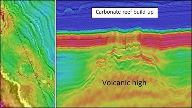
15th June 2018
CGG Delivers Final PSTM Products for Dunquin Multi-Client Survey15th June 2018
Hexagon introduces HxGN MineOperate UG Pro for Miners15th June 2018
PDF3D's Global Expansion Continues with IDI Collaboration in Japan15th June 2018
New Light Technologies and Boundless Announce Strategic Partnership
15th June 2018
FIFA World Cup 2018 Stadiums As Seen From Space
15th June 2018
GSSI Showcases and Demonstrates World Leading GPR Systems in Switzerland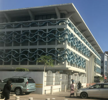
15th June 2018
GAF to provide consulting services in Mozambique15th June 2018
Sun Moon Lake National Scenic Area Administration offers a mobile tour guide app in Shueili Che-Chen
14th June 2018
EarthSense Activates Zero Emission Running to Reduce City Air Pollution
14th June 2018
Grid Analytics Europe 2018, 25-27 September 2018, London
14th June 2018
Mansfield District Council looks to Cadcorp web mapping to reduce GIS maintenance overheads14th June 2018
Nanotron wins Geo IOT World award for indoor location and proximity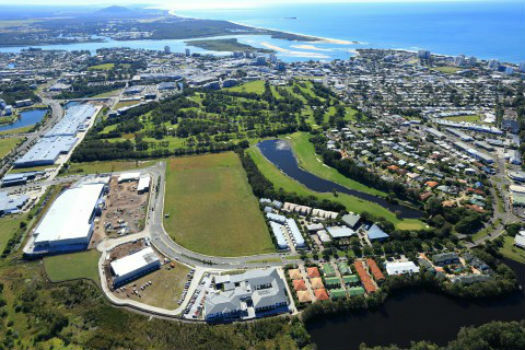
14th June 2018
Sunshine Coast Council and Pitney Bowes Develop Smart City Results14th June 2018
Hexagon's Mining division launches streamlined product portfolio13th June 2018
BLK3D imager from Leica Geosystems raises the bar in 3D measurement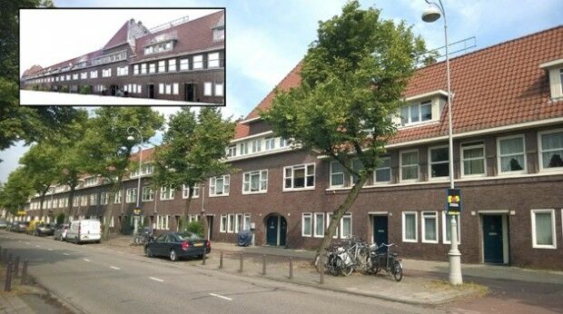
13th June 2018
Pointfuse 3D Models Boost Social Housing Management