
News
News as it happens! Keep in touch with the latest developments in business and technology in the regions or worldwide.

OGC seeks public comment on Tile Matrix Set Candidate Standard
26th June 2018
OGC seeks public comment on Tile Matrix Set Candidate Standard
OpenPlant CONNECT Edition Deploys Bentley’s Innovative iModelHub
26th June 2018
OpenPlant CONNECT Edition Deploys Bentley’s Innovative iModelHub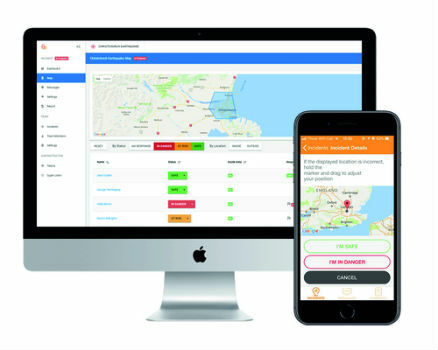
New app enables employers to instantly locate staff in event of terror attack
26th June 2018
New app enables employers to instantly locate staff in event of terror attack
Airbus to provide an end-to-end Geo-Information System to Thailand
26th June 2018
Airbus to provide an end-to-end Geo-Information System to Thailand
Women Presidents’ Organization Welcomes Blakelee Mills As Newest Member
26th June 2018
Women Presidents’ Organization Welcomes Blakelee Mills As Newest Member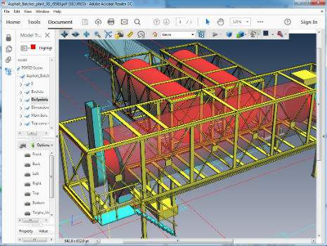
PDF3D Version 2.16 Focuses on CAD, CAE, Panoramic 360 and Engineering
26th June 2018
PDF3D Version 2.16 Focuses on CAD, CAE, Panoramic 360 and Engineering
thinkWhere In Pole Positions with of 8 Years of Quality Certification
26th June 2018
thinkWhere In Pole Positions with of 8 Years of Quality CertificationTOPCON INDIA - Tunnel Analysis by Aplitop's Software
26th June 2018
TOPCON INDIA - Tunnel Analysis by Aplitop's Software
Silicon Sensing increases gyro production by 30%
25th June 2018
Silicon Sensing increases gyro production by 30%
Cloud to power Canary Wharf Digital Transformation
25th June 2018
Cloud to power Canary Wharf Digital Transformation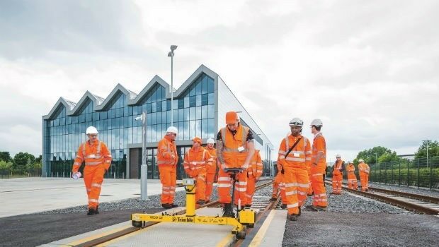
KOREC launches Trimble’s GEDO IMS to key players in the UK rail industry
25th June 2018
KOREC launches Trimble’s GEDO IMS to key players in the UK rail industry
“Forecasts for drones are wrong” says leading British drone expert
25th June 2018
“Forecasts for drones are wrong” says leading British drone expert
Creating Mobile Apps with Big Data from Space
25th June 2018
Creating Mobile Apps with Big Data from Space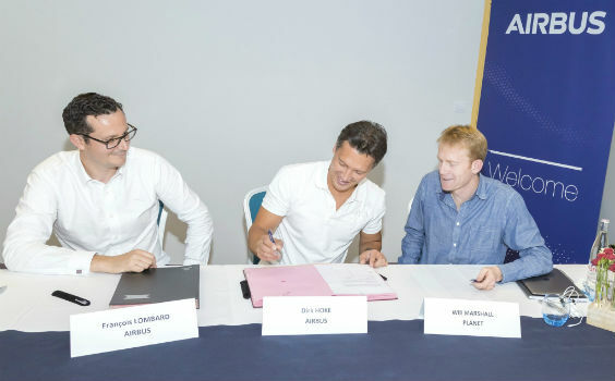
Airbus and Planet join forces to bring new geospatial products to market
25th June 2018
Airbus and Planet join forces to bring new geospatial products to market
GEOMAKANI 2018 “3rd Geospatial Technologies Conference”
25th June 2018
GEOMAKANI 2018 “3rd Geospatial Technologies Conference”
Free Business Location Data for Use with Maptitude 2018
23rd June 2018
Free Business Location Data for Use with Maptitude 2018
Airbus to supply satellite communications system
23rd June 2018
Airbus to supply satellite communications system
GeoPlace and JAG(UK) help councils cut driver disruption
22nd June 2018
GeoPlace and JAG(UK) help councils cut driver disruption
Esri User Conference Highlights Where Mapping Technology Is Headed Next
22nd June 2018
Esri User Conference Highlights Where Mapping Technology Is Headed Next
Safe Software renews FME Certification for 1Spatial's Mary O'Brien
22nd June 2018
Safe Software renews FME Certification for 1Spatial's Mary O'Brien
Soar TGE to generate the world’s first fully decentralised global super-map using drones
22nd June 2018
Soar TGE to generate the world’s first fully decentralised global super-map using drones