
Leica BLK360 software integration announcement
22nd May 2019
Leica BLK360 software integration announcementNews as it happens! Keep in touch with the latest developments in business and technology in the regions or worldwide.
22nd May 2019
Leica BLK360 software integration announcement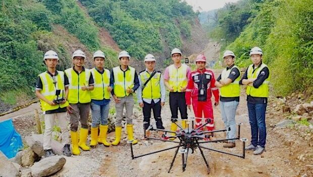
22nd May 2019
Terra Drone Indonesia shows construction companies benefits
22nd May 2019
Mapillary announces the world's first demand-driven marketplace for map data
21st May 2019
Trimble Releases Next-Generation Integrated Smartphone and GIS Data Collector

21st May 2019
public comment on major revision to OGC Abstract SpecificationTopic 021st May 2019
Space Flight Laboratory to Highlight ‘Gray Jay’
21st May 2019
New Open Payload version of Delair DT26 UAV allows custom configuration_enabling_tru.jpg)
21st May 2019
Introducing Multipurpose Autonomous sub-surface Training Target21st May 2019
Airbus signs MOU with Hellenic Space Agency for future space cooperation
21st May 2019
Gaist’s mapping solution could boost efficiency for utilities market

21st May 2019
Sonardyne acquires maritime survey software and construction specialist EIVA
20th May 2019
Hemisphere GNSS Announces All-New OEM Positioning & Heading Boards
20th May 2019
Carlson NR3: New compact, lightweight GNSS Receiver20th May 2019
AEC Next and SPAR 3D Expo & Conference Gets Underway Tomorrow
20th May 2019
Fugro supports two ocean mapping initiatives20th May 2019
Topcon accepts John Deere Supplier Innovation Award

20th May 2019
Spectra Group to exhibit at the SOFIC exhibition in Tampa Florida.
20th May 2019
Bluesky and Getmapping Embrace XMAP for UK Government