Trimble Announces New AI Agents and Workflows to Automate Critical Transportation Operations
24th November 2025
Trimble Announces New AI Agents and Workflows to Automate Critical Transportation OperationsNews as it happens! Keep in touch with the latest developments in business and technology in the regions or worldwide.
24th November 2025
Trimble Announces New AI Agents and Workflows to Automate Critical Transportation Operations
24th November 2025
Trimble Expands Connected Solution Integrations to Address Transportation Industry Challenges
21st November 2025
UP42 Announces Partnership with NV5, Adding LiDAR Data to their Ecosystem
21st November 2025
Embedded Works Partners With Queclink To Target Fleet Technology Growth
20th November 2025
GMV’s UK subsidiary strengthens space safety with its new collision avoidance capability for LEO constellations
20th November 2025
Kongsberg NanoAvionics expands in the UAE and partners with MBRSC to develop five CubeSats for future PHI missions
19th November 2025
German Orbital Systems to deploy Neuraspace’s space traffic management for pilot satellite of ESA’s Celeste mission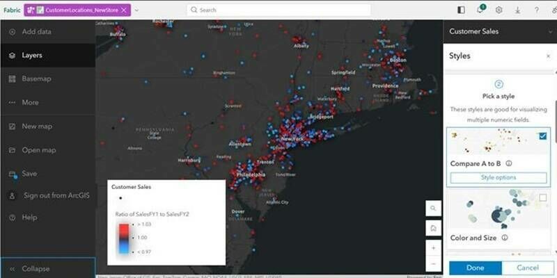
19th November 2025
Esri Introduces Latest ArcGIS Integrations for Microsoft Fabric
18th November 2025
Space42 Successfully Completes First Public Test Flight of ApusNeo18 HAPS in the UAE
18th November 2025
Postrack Becomes The First Order Now Partner In Europe For Asset Tracking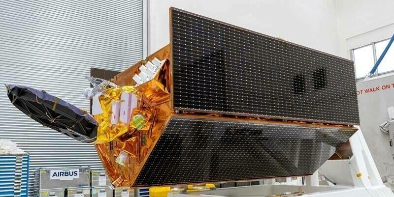
17th November 2025
Successful launch of Airbus-built Sentinel-6B climate satellite
17th November 2025
New Report Urges Immediate Action to Realise the Value of Location Intelligence
14th November 2025
KOREC signs reseller agreement with Terrasolid
14th November 2025
Safe Software Ahead of Target to Reach $250M in Revenue by 2028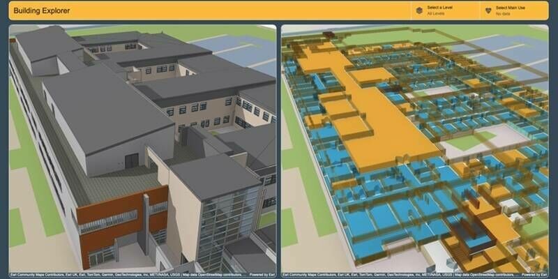
13th November 2025
Manchester University NHS Foundation Trust creates smart estate with digital twin
13th November 2025
SFL Missions Awarded Contract for Additional GHGSat Greenhouse Gas Monitoring Microsatellites
12th November 2025
Collaboration between EuroGeographics and European Environment Agency increases number of official national geospatial datasets available via CORDA
12th November 2025
Spirent Extends High-Performance GNSS Simulation to More Users Across the Development Lifecycle
11th November 2025
New Wingtra-Trimble partnership brings seamless data integration for KOREC drone customers
11th November 2025
Thuraya Enters South African Market for the First Time with Thuraya-4 Commercial Rollout
10th November 2025
Slagboom & Peeters Aerial Surveys Becomes First Worldwide Customer of Vexcel’s New UltraCam Dragon 4.2
10th November 2025
Giant leap forward for North Sea data sharing
7th November 2025
Space42 and Autonomous A2Z Establish Joint Venture to Accelerate Autonomous Mobility Transformation in the UAE
7th November 2025
Trak Global Security Solutions Targets SVR Fleet Innovation With Queclink Partnership