Share
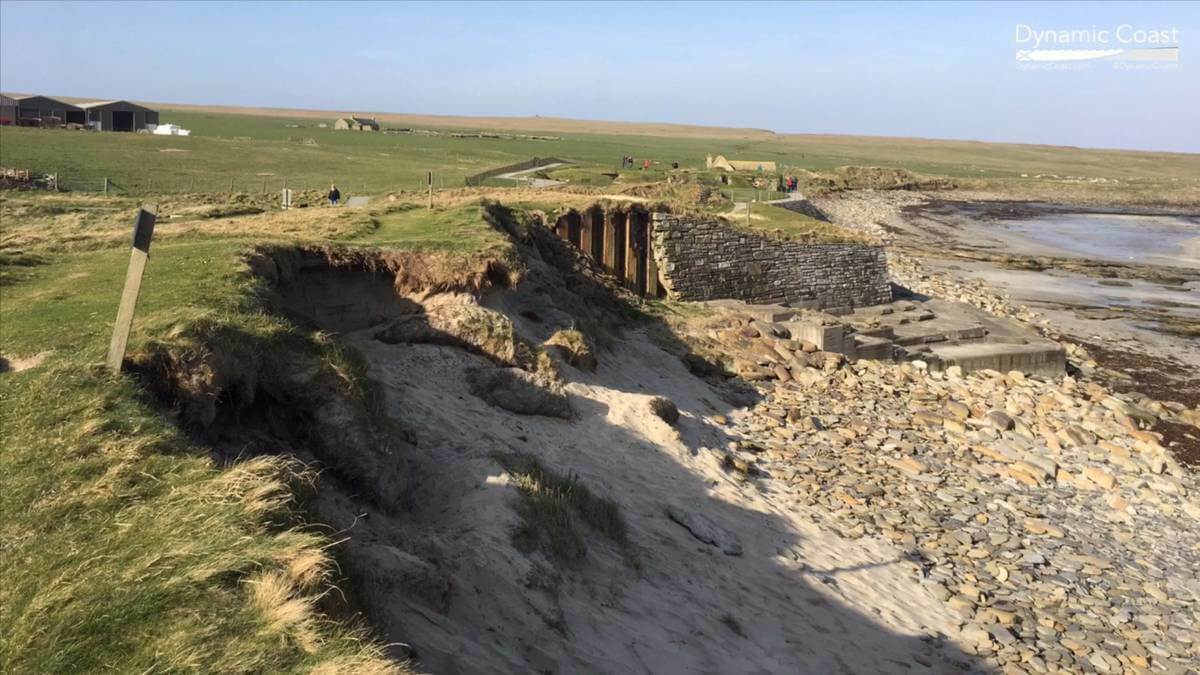
Research carried out by the University of Glasgow using Esri’s Geographic Information Software (GIS) has found that coastal erosion is occurring more quickly and across more of Scotland’s coastline than previously recorded – putting homes, businesses, infrastructure and natural habitats at risk.
The award-winning research project, called Dynamic Coast, has been carried out to anticipate how climate change will affect Scotland’s coasts. By comparing the likely locations of erosion over time with the locations of existing coastal structures, the team identified assets with a value of £1.2 billion that are potentially at risk by 2050, if the world maintains its increasing global green-house gas emissions The study also revealed that Scotland could avoid £400 million in damage to coastal assets if emissions are cut quickly.
The research team used Esri’s ArcGIS technology to analyse geo-rectified historical maps from the 1890s and 1970s, alongside modern maps and LiDAR. It then modelled future changes in the coastline, considering different sea level rises under various climate change scenarios.
This initiative was funded by the Scottish Government, via Scotland’s Centre of Expertise for Waters (CREW), together with NatureScot and the St Andrews Links Trust. The research itself was carried out by the University of Glasgow.
“ArcGIS allows powerful analysis on coastal change to be undertaken and shared with the public, so that Scotland’s businesses and communities can become more sea-level wise and resilient to climate change,” commented Dr Alistair Rennie, Dynamic Coast Project Manager at NatureScot.
Alistair explains more, “In a first for the UK, you can explore maps of our future coastal erosion under a high emissions or low emissions future. The side-by-side maps are available at www.DyamicCoast.com and were created using ArcGIS on-line’s Dashboard.”
“Planning space needs to be found for a future coast, and its assets, located landward of present. Allowing existing and new development on eroding coasts locks us into costly and risky futures. ArcGIS helps identify which coastal land-use options are sustainable,” commented Professor Jim Hansom, Dynamic Coast research lead at the University of Glasgow.
“In order to mitigate and adapt to climate change, we must understand how the environment is likely to change over the coming decades” said Stuart Bonthrone, Managing Director, Esri UK. “By using GIS, it’s now possible to take historical data and model it forwards to predict what the future will look like based on current trends. By visualising this data on a map, it creates a clear picture of where issues will occur – and means that early action can be taken to avert a future crisis.”
People who live, work, and invest in coastal areas can now access the interactive maps and reports on DynamicCoast.com to help them consider short-term resilience measures and develop flexible long-term adaptation strategies. As the data is displayed on simple-to-use interactive maps via ArcGIS Online, all stakeholders can more easily understand the implications of climate change to their coastline, plan ahead, and adapt to reduce their exposure to risk.
Subscribe to our newsletter
Stay updated on the latest technology, innovation product arrivals and exciting offers to your inbox.
Newsletter

