
Elbit to Supply BrightNite™ Systems to an Air Force in a NATO Country
17th January 2017
Elbit to Supply BrightNite™ Systems to an Air Force in a NATO Country
17th January 2017
Elbit to Supply BrightNite™ Systems to an Air Force in a NATO Country
17th January 2017
Fugro Attains Authorised Economic Operator Status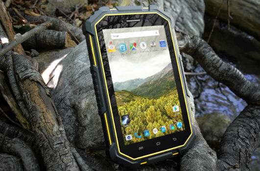
17th January 2017
Juniper Systems Launches New CT7G Rugged Tablet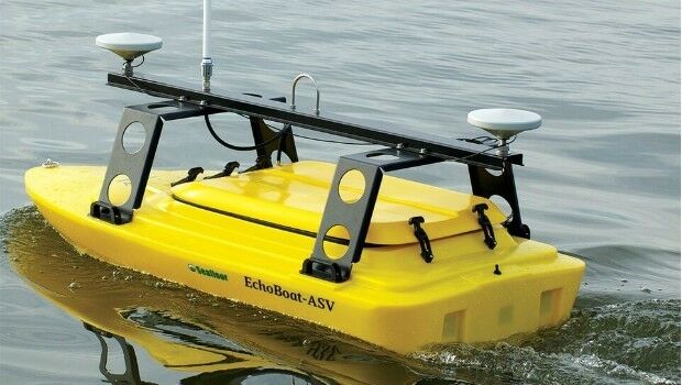
17th January 2017
Seafloor's Dockside Demo at Ocean Business '17, Southampton:16th January 2017
The key to flying drones safely is education16th January 2017
HERE supports rollout of Baidu Maps to rest of world
16th January 2017
exactEarth Adds 4 Payloads to Second Generation Constellation16th January 2017
Successful Initial Launch for Second Generation Real-Time Constellation
16th January 2017
Juniper Systems has a new rugged Android smartphone available
16th January 2017
Juniper Systems has a new rugged Android® tablet available16th January 2017
How IoT and Data Science are creating Smart Transportation in Europe
16th January 2017
Airbus Defence and Space ships SES-10 telecom satellite to launch site16th January 2017
Infinera Transforms Subsea Networks to Cloud Scale13th January 2017
USGIF CEO Reappointed as Vice Chair of the NGAC
13th January 2017
ARBOR Wins 4 Taiwan Excellence Awards, that's a begin for 2017
13th January 2017
TomTom Traffic increases global footprint to 54 countries12th January 2017
CGG GeoSoftware donates HampsonRussell software
12th January 2017
Caltrans Takes Delivery of the RIEGL VMX-1HA
12th January 2017
Airbus Launches “Enter the SpaceDataHighway” Challenge11th January 2017
Yotta: New Business Development Managers for Australia and New Zealand
11th January 2017
Training & Demonstration Programme at the Heart of Ocean Business 2017.jpg)
11th January 2017
Conversion Drone Training for EuroUSC Students on BNUC-S Course11th January 2017
Lovell Johns, Showcase 50 Years of Expertise with New Website
11th January 2017
Faster, more accurate GPS/GNSS receiver validation now possible11th January 2017
Collaboration with Deimos Imaging to Support the PanGeo Alliance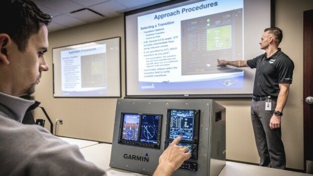
11th January 2017
Garmin announces new 2017 classroom pilot training classes11th January 2017
Certificate of Networthiness for GeoExpress and Express Server Software10th January 2017
OceanWise and IMarEST to run Marine Data Management Awareness Course10th January 2017
The FME World Tour is Coming to the UK, Australia & Singapore in 2017
10th January 2017
Dreams Improves On Site Customer Experience With Flexipod
9th January 2017
Ecometrica secures breakthrough £14.2m UK Space Agency contract9th January 2017
PTV Group Launches Academic Program at 2017 TRB9th January 2017
Intergraph Government Solutions Announces Corporate Name Change
9th January 2017
ABPmer reviews Western Isles' harbour authority operations9th January 2017
BARSC Welcomes the Satellite Applications Catapult as New Member9th January 2017
Arcus Global joins Cadcorp Business Partner Network programme9th January 2017
Linkadia chooses Digital Element for mobile advertising efficiency
9th January 2017
Jacob Bangsgaard appointed to lead ERTICO
7th January 2017
Remote AIS AtoN Ocean Current Monitoring Systems6th January 2017
Southern Hemisphere Space Program to tackle the final frontier6th January 2017
Sky’s the limit for DJI and HERE’s global drone mapping partnership