
Rocket Lab launched a NanoAvionics satellite bus carrying NASA’s solar sail system aboard
25th April 2024
Rocket Lab launched a NanoAvionics satellite bus carrying NASA’s solar sail system aboardNews as it happens! Keep in touch with the latest developments in business and technology in the regions or worldwide.
25th April 2024
Rocket Lab launched a NanoAvionics satellite bus carrying NASA’s solar sail system aboard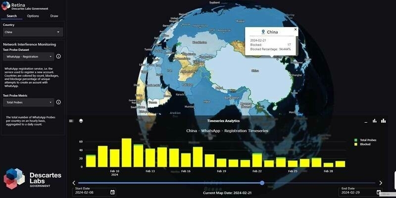
25th April 2024
Descartes Labs Government Launches Retina at GEOINT 2024, Fusing OSINT and GEOINT into a Single Pane of Glass
24th April 2024
RIEGL Webinar Announcement: An Amazing LiDAR Expedition to Alcatraz – Through the Eyes of RIEGL Technology
24th April 2024
AGI Awards for Excellence to be Announced at GEO Business 24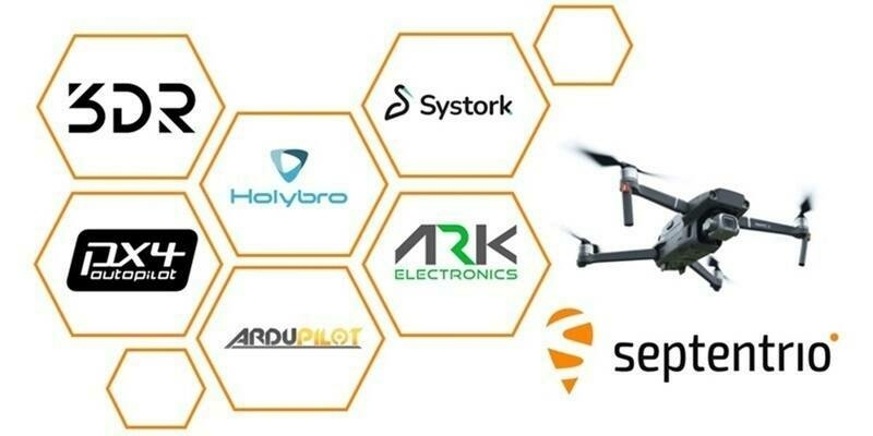
23rd April 2024
Septentrio expands UAV ecosystem for reliable GNSS positioning
23rd April 2024
New Qualcomm-Built Advanced Video Processor by Teledyne FLIR Powers AI at the Edge
22nd April 2024
DSI’s SmallSat and Space Access Summit is Returning for It’s 7th Iteration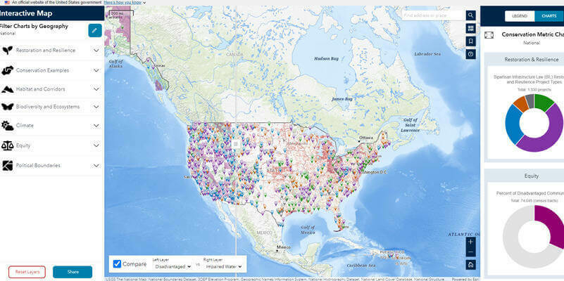
22nd April 2024
Biden-Harris Administration Launches Conservation.gov
22nd April 2024
How OS expert mapmakers see the world differently
19th April 2024
Virtual Surveyor Adds Planimetric Survey Functionality to Latest Release of Smart Drone Surveying Software
19th April 2024
YNSAT Awarded ESA Contract for Satellite Imagery Processing and Visualization Platform
18th April 2024
Ordnance Survey And Sensat Collaboration Will Redefine Standards Of Data Visualisation
18th April 2024
New Chairs Announced at Association for Geographic Information
17th April 2024
World Hydrogen North America doubles in size to keep pace with exponential growth of hydrogen industry
17th April 2024
Creaform Is Making Automated Quality Control Accessible with a New, Versatile and Intuitive Hybrid Solution
17th April 2024
Teledyne FLIR IIS announces a new stereo vision product for high accuracy robotics applications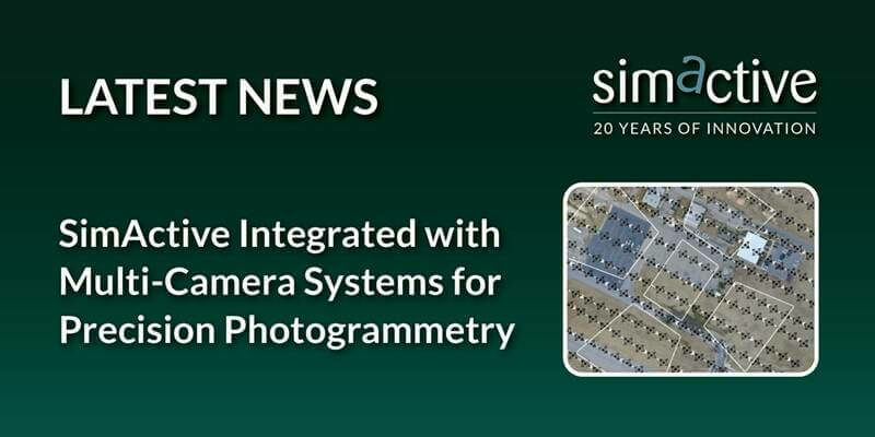
16th April 2024
SimActive Integrated with Multi-Camera Systems for Precision Photogrammetry
16th April 2024
St. Pancras International Partners with Living Map to Launch Digital Wayfinding Solution
15th April 2024
Blackshark.ai SYNTH3D Terrain Data now available in VBS
15th April 2024
Strategic agreements integrate Topcon technology into solutions from Bentley Systems and Worldsensing
12th April 2024
London Gatwick creates new geospatial platform with GIS from Esri UK
12th April 2024
Astroscale’s ADRAS-J Completes Successful Rendezvous and Initiates Proximity Approach
11th April 2024
Septentrio mosaic GPS/GNSS now also available in MIKROE Click board ecosystem
11th April 2024
Sercel Announces First Commercial Sale of its New 528 Land Acquisition System