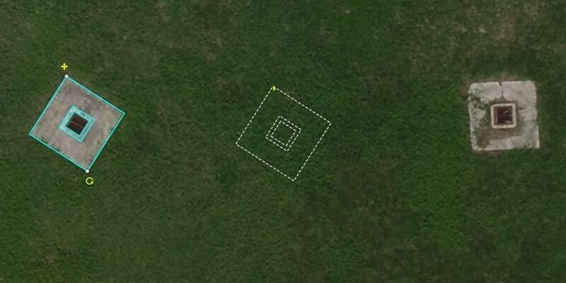
Virtual Surveyor Adds Planimetric Survey Functionality to Latest Release of Smart Drone Surveying Software
19th April 2024
Virtual Surveyor Adds Planimetric Survey Functionality to Latest Release of Smart Drone Surveying SoftwareNews as it happens! Keep in touch with the latest developments in business and technology in the regions or worldwide.
19th April 2024
Virtual Surveyor Adds Planimetric Survey Functionality to Latest Release of Smart Drone Surveying Software
19th April 2024
YNSAT Awarded ESA Contract for Satellite Imagery Processing and Visualization Platform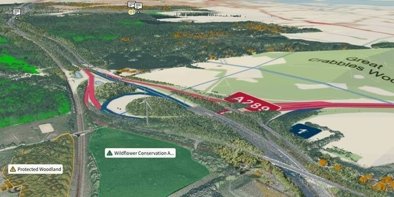
18th April 2024
Ordnance Survey And Sensat Collaboration Will Redefine Standards Of Data Visualisation
18th April 2024
New Chairs Announced at Association for Geographic Information
17th April 2024
World Hydrogen North America doubles in size to keep pace with exponential growth of hydrogen industry
17th April 2024
Creaform Is Making Automated Quality Control Accessible with a New, Versatile and Intuitive Hybrid Solution
17th April 2024
Teledyne FLIR IIS announces a new stereo vision product for high accuracy robotics applications
16th April 2024
SimActive Integrated with Multi-Camera Systems for Precision Photogrammetry
16th April 2024
St. Pancras International Partners with Living Map to Launch Digital Wayfinding Solution
15th April 2024
Blackshark.ai SYNTH3D Terrain Data now available in VBS
15th April 2024
Strategic agreements integrate Topcon technology into solutions from Bentley Systems and Worldsensing
12th April 2024
London Gatwick creates new geospatial platform with GIS from Esri UK
12th April 2024
Astroscale’s ADRAS-J Completes Successful Rendezvous and Initiates Proximity Approach
11th April 2024
Septentrio mosaic GPS/GNSS now also available in MIKROE Click board ecosystem
11th April 2024
Sercel Announces First Commercial Sale of its New 528 Land Acquisition System
10th April 2024
Creaform introduces the MetraSCAN BLACK+ and MetraSCAN BLACK+|Elite
10th April 2024
u-blox incorporates newest Nordic Semiconductor Bluetooth chips in two new compact modules
9th April 2024
Meeting place for the global geospatial community – Stuttgart is being transformed into a stage for sustainable solutions and international cooperation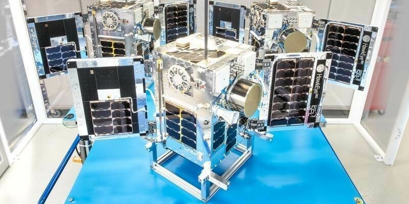
9th April 2024
Space Flight Laboratory (SFL) Confirms Successful Deployment of HawkEye 360 Microsatellite Clusters 8 and 9
8th April 2024
Esri’s ArcGIS Basemaps Integrated into Autodesk Civil 3D and AutoCAD
8th April 2024
Teledyne FLIR IIS Announces a New Online Platform for Selecting Optimal Machine Vision Components for Imaging Systems
5th April 2024
Tomaž Petek elected President of EuroGeographics
5th April 2024
HawkEye 360 Secures $40 Million Debt Commitment
4th April 2024
TDI-Brooks Completes Large Survey Campaign Off New York And New Jersey